)
Barrow GNSS Survey System - Available Equipment
Equipment Available

A geodetic system consisting of a dual-frequency base station and roving receiver is available in Barrow. By collecting and post-processing data, centimeter-level accuracy can be realized over 100 kilometers away from Barrow. A second GPS base station in Barrow, the Barrow SuomiNet site SG27, provides a backup to the BASC base station for post-processing. Note that a separate base station is maintained by UNAVCO in Atqasuk, AK for surveys in that area. Data from site BARO, SG27, and ATQK are available on-line from the UNAVCO Data Archive. Data processing software is also available from UNAVCO.
In addition, the base station transmits real-time kinematic (RTK) broadcasts at 418 MHz (CMR+ format at 9600 baud). This provides real-time centimeter-level capability within a ~10 km radius of the BARC building. A second portable RTK radio repeater is available to assist RTK work elsewhere in the Barrow area.
| The following GPS equipment is available for use in Barrow: | |
|---|---|
 |
Trimble NetR8 GNSS Base Station Geodetic GNSS base station for data collection and RTK broadcasting. An equipment inventory is maintained on this page. |
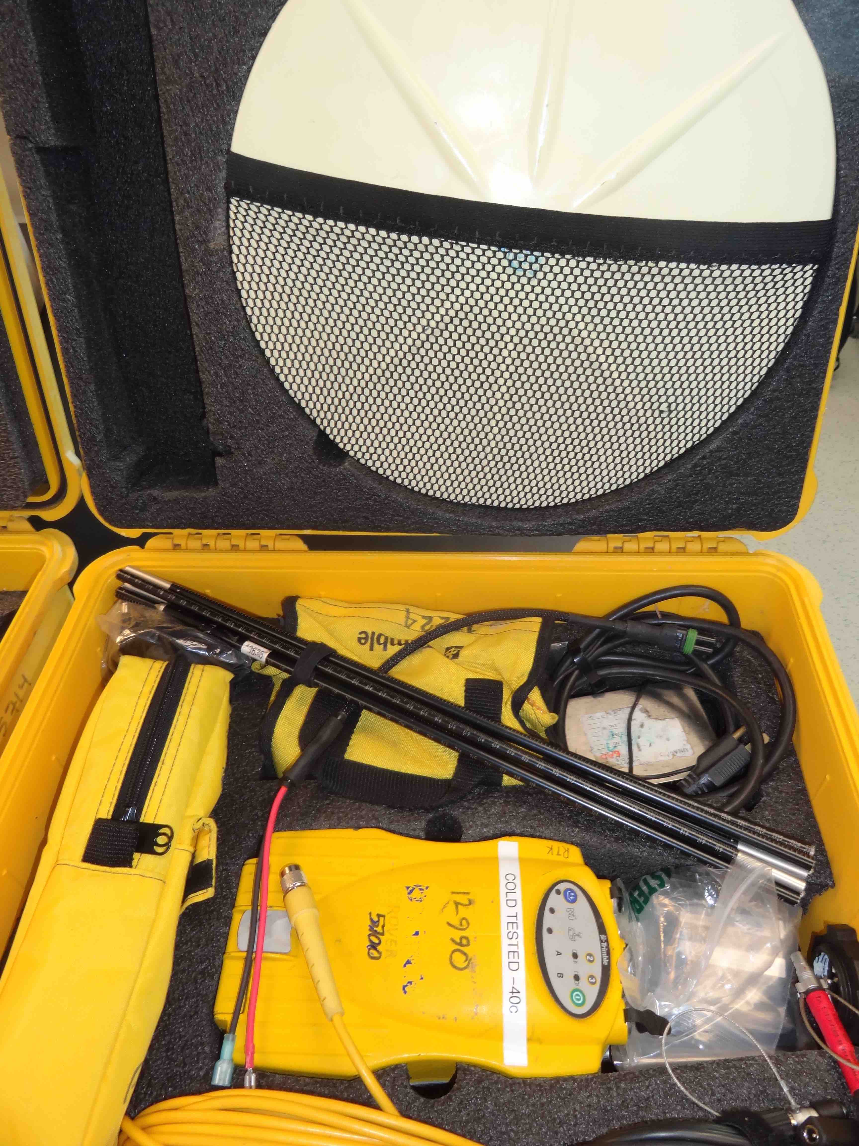 |
R8 GNSS Rover Survey Systems Geodetic GPS receiver and ancillary field equipment that provides centimeter accuracy in real-time (RTK) or through data collection and post-processing. An equipment inventory is maintained on this page. |
SuomiNet auxiliary GPS base station | |
 |
Barrow SuomiNet GPS Station SG27 A fixed geodetic GPS base station is located at the NOAA GMD Facility, and provides a post-processing backup to the GPS base station at BASC. RINEX data files (15 sec) are available on-line from the UNAVCO Data Archive. Higher-rate data are also available, but are only downloaded upon request and are not archived. To obtain high-rate data, fill out an online request form. Note that high-rate data is stored in a ring buffer on the receiver and will not persist indefinitely, therefore data requests should be made as soon as possible after the need is identified. |
SG27 coordinates (Survey Mark): ITRF-05, June 1 2010:
NAD-83, June 1 2010:
Elevation above mean sea level (Survey Mark):
GEOID-99 model applied to NAD-83 coordinates, June 1 2010: |
|
Last modified: 2019-12-24 02:12:47 America/Denver