
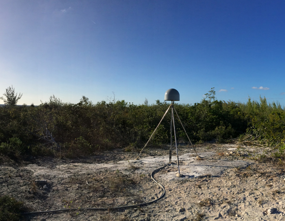
Panorama of completed site CN14 on on Great Inagua, Bahamas. Photo by John Sandru, UNAVCO 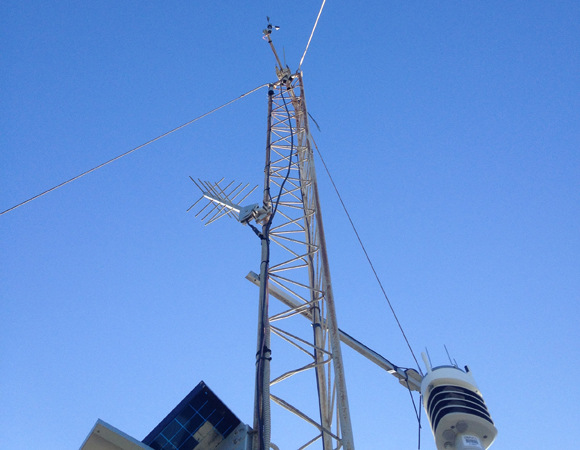
The met pack for CN14 on Great Inagua, Bahamas. Photo by John Sandru, UNAVCO 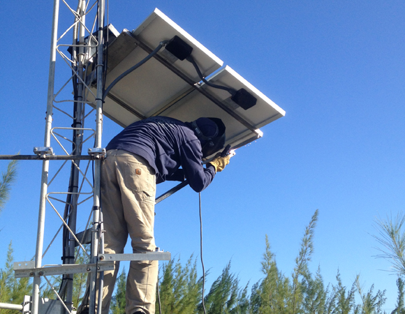
Welding the solar panel mount for site CN14 on Great Inagua, Bahamas. Photo by John Sandru, UNAVCO 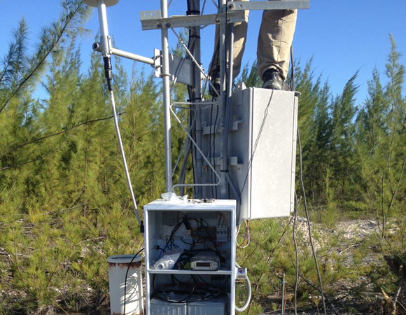
The instumentaion and power enclosure on a tower for CN14 on Great Inagua, Bahamas. Photo by John Sandru, UNAVCO. 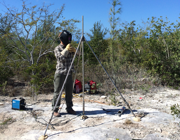
UNAVCO field engineer Keith Williams welds the GPS antenna monument for CN14 on Great Inagua, Bahamas. Photo by John Sandru, UNAVCO 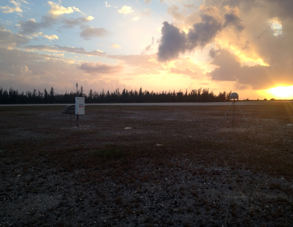
Sunset at the finished site. CN13 on San Salvador Island, Bahamas. Photo by John Sandru, UNAVCO 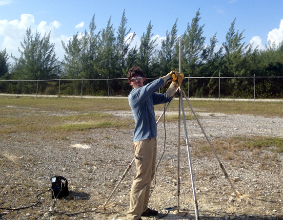
UNAVCO field engineer Jacob Sklar welds the GPS antenna monument for CN13 on San Salvador Island, Bahamas. Photo by John Sandru, UNAVCO 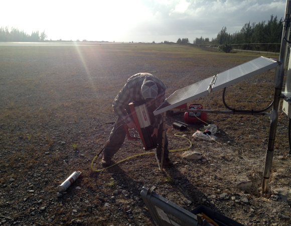
UNAVCO field engineer Keith Williams installs the solar panel mount for CN13 on San Salvador Island, Bahamas. Photo by John Sandru, UNAVCO 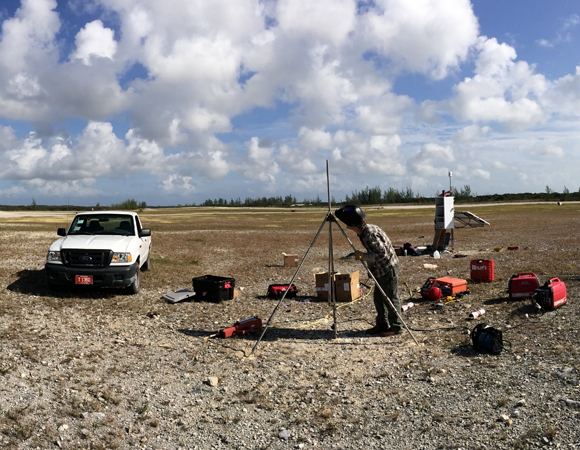
Panorama of CN13 on San Salvador Island, Bahamas. Photo by John Sandru, UNAVCO 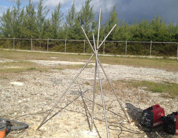
Framework for the GPS antenna monument for CN13 on San Salvador Island, Bahamas. Photo by John Sandru, UNAVCO
Project Overview
Determining how the Caribbean plate moves with respect to the neighboring North America and South America plates has been a major challenge. Geologic plate motion models using seafloor magnetic anomaly rates, transform fault azimuths, and slip vectors are challenging due to sparse data. The only rates come from the Cayman Spreading Center, and seismicity at the eastern boundary is low due to slow convergence. Moreover, the boundary geometry is still unclear, since the Caribbean plate’s north and south boundaries are complex deformation zones.
GPS data continues to provide key clues to the Caribbean region’s geologic faults. GPS stations are currently being installed as part of the Continuously Operating Caribbean GPS Observational Network (COCONet), strengthening the indispensible collection of data belonging to a region that faces many atmospheric and geologic natural hazards.
UNAVCO Connection
While the hardware used in the Plate Boundary Observatory works well in temporate climates, COCONet requires hardware better suited to hot, humid, and salty environs. UNAVCO has moved away from the metal hardware and enclosures of PBO to all plastic hardware and enclosures. Even stainless steel in the Caribbean starts to rust anywhere it has been welded or is in contact with another type of alloy such as aluminum. Anything that is just zinc coated rust away in about a year. For sites in the most corrosive environments, like the COCONet sites in Jamaica, we protect the metal monuments with multiple coats of marine paint.
CN13 and CN14 were installed in conjunction with The Bahamas Metrological Department. CN13 was installed on San Salvador Island, which is the original landing location of Christopher Columbus. It continues to be a popular dive location. CN14 is located on Great Inagua, a birders’ paradise and the most southern island of the Bahamas chain. It is also home to Morton Salt, the main employer of the island.
Significance
The COCONet project was funded by the National Science Foundation (NSF) with the aim of developing a large-scale geodetic and atmospheric infrastructure in the Caribbean that will form the backbone for a broad range of geoscience and atmospheric investigations and enable research on process-oriented science questions with direct relevance to geohazards. The Caribbean Plate is a unique opportunity to monitor movement, because most of the plate rests underwater. Prior to this endeavor there has been limited monitoring of the Caribbean Plate. Furthermore, each site is equipped with a weather station which records vital atmospheric data that is analyzed by our friends at the University Corporation for Atmospheric Research (UCAR) to monitor the movement of potentially deadly hurricanes.
Project Information
- Principal Investigators: COCONet
- UNAVCO Engineers: John Sandru, Jacob Sklar, and Keith Williams
- Date: January 21 – 31, 2014
- Locations: COCONet Sites CN13 and CN14: Bahamas
- Funding Source: NSF, COCONet
- Map of Bahamas
Related Links
Written by:
- John Sandru and Beth Bartel
- Posted: 14 February 2014
- Last updated: 29 June 2021
- Tags: COCONet, GPS/GNSS, project highlights
-

