
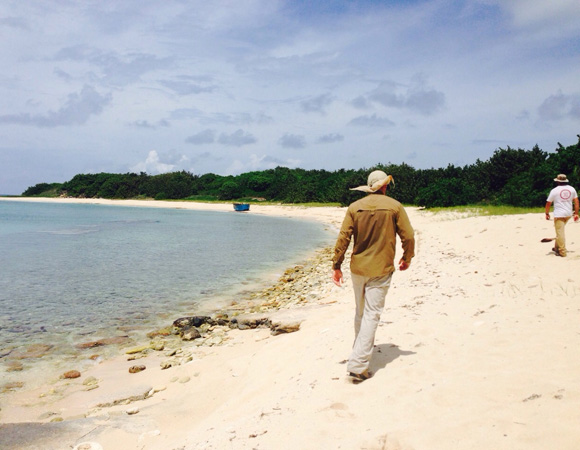
UNAVCO field engineers Michael Fend (left) and John Sandru (right) scout out an installation location on Swan Island, Honduras for cGPS site CN18. Photo by Marissa Garcia 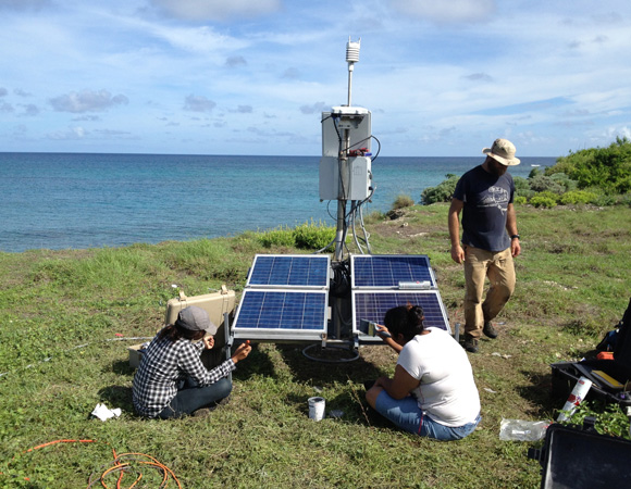
Local engineering students from UPI assisted with the installation of cGPS site CN18 on Swan Island, Honduras. Photo by Michael Fend, UNAVCO 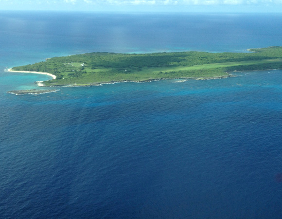
An aerial view of Swan Island, Honduras, where cGPS site CN18 is installed. Photo by Michael Fend, UNAVCO 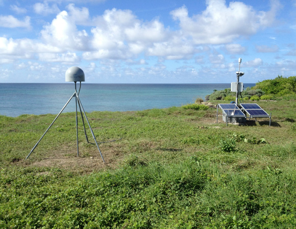
Vista of cGPS site CN18 on Swan Island, Honduras. Photo by Michael Fend, UNAVCO
Project Overview
Determining how the Caribbean plate moves with respect to the neighboring North America and South America plates has been a major challenge. Geologic plate motion models using seafloor magnetic anomaly rates, transform fault azimuths, and slip vectors are challenging due to sparse data. The only rates come from the Cayman Spreading Center, and seismicity at the eastern boundary is low due to slow convergence. Moreover, the boundary geometry is still unclear, since the Caribbean plate’s north and south boundaries are complex deformation zones.
GPS data continues to provide key clues to the Caribbean region’s geologic faults. GPS stations are currently being installed as part of the Continuously Operating Caribbean GPS Observational Network (COCONet), strengthening the indispensible collection of data belonging to a region that faces many atmospheric and geologic natural hazards.
UNAVCO Connection
Newly installed COCONet cGPS site CN18 on Swan Island, Honduras sits on the edge of the Cayman Trough, far from the Honduran mainland and poised to collect particularly valuable atmospheric and geodetic data because it will provide coverage in a remote part of the world with little data availability. Approximately 165 miles off the mainland coast, Swan Island serves as a military outpost for the Honduran Navy. The remoteness of the site and a hot, muggy, and buggy climate made this a particularly difficult installation.
UNAVCO engineers collaborated with multiple local organizations, including the Universidad Politécnica de Ingeniería de Honduras (UPI), Instituto Geográfico Nacional de Honduras (IGN), Island Air, and the Honduran Navy. The IGN assisted with customs and storage of equipment, while the Honduran Navy assisted with shipping the equipment to Swan Island and UNAVCO chartered flights from Island Air. UPI engineering students Nancy Mazarigos, Marissa Garcia, and Patricia Eveline assisted UNAVCO engineers John Sandru and Michael Fend throughout the entire installation process. The students learned about GPS technology through participating in a unique GPS installation in a remote part of the world.
Significance
The COCONet project was funded by the National Science Foundation (NSF) with the aim of developing a large-scale geodetic and atmospheric infrastructure in the Caribbean that will form the backbone for a broad range of geoscience and atmospheric investigations and enable research on process-oriented science questions with direct relevance to geohazards. The Caribbean Plate is a unique opportunity to monitor movement, because most of the plate rests underwater. Prior to this endeavor there has been limited monitoring of the Caribbean Plate. Furthermore, each site is equipped with a weather station which records vital atmospheric data that is analyzed by our friends at the University Corporation for Atmospheric Research (UCAR) to monitor the movement of potentially deadly hurricanes.
Project Information
- Principal Investigators: COCONet
- UNAVCO Engineers: Michael Fend and John Sandru
- Date: September 25th-27th, 2014
- Locations: COCONet Site CN18: Honduras
- Funding Source: NSF, COCONet
- Map of Swan Island, Honduras
Related Links
Written by:
- Michael Fend and Celia Schiffman
- Posted: 5 December 2014
- Last updated: 28 June 2021
- Tags: COCONet, GPS/GNSS, project highlights
-

