
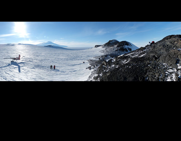
The newly-installed cGPS station at Toney Mountains. This wind scoured outcrop took 4 separate flights to scout out and successfully install the station in early 2012. 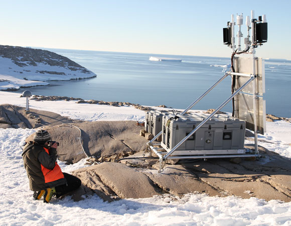
The newly-installed cGPS station at Backer Island near the calving terminus of the massive Pine Island Glacier. 
The recent cGPS installation at Lepley Nunatak. This site has been the most elusive install in the POLENET system.
Project Overview
The POLENET (Polar Earth Observing Network) project focuses on collecting GPS and seismic data from autonomous systems deployed at remote sites spanning much of the Antarctic and Greenland ice sheets. GPS and seismic measurements together provide a means to answer critical questions about ice sheet behavior. Determining the vertical and horizontal velocity fields associated with ice mass changes will provide much needed data to better understand ice dynamics, changes in sea level, crustal deformation, mantle properties and many other geophysical questions.
Field Season
As a part of ongoing UNAVCO support of the POLENET project, three new continuous GPS stations were installed in Western Antarctica. One of the planned sites remains uninstalled after an exhaustive search for suitable bedrock for a GPS antenna mast in the Pine Island Glacier sector. 28 stations installed during the previous 4 seasons were visited for upgrades to the latest configurations, design improvements, and a few large repairs.
Network Status
There are currently 42 stations in the POLENET Antarctica network. Data from these sites are transmitted via Iridium satellite communications (for remote sites) or point-to-point radios for (McMurdo close sites) back to the Boulder Facility for near real time data archiving.
Project Information
- Principal Investigator: Terry Wilson, Ohio State University
- UNAVCO Engineer: Jeremy Miner (UNAVCO), Seth White (UNAVCO), Ellie Boyce (UNAVCO)
- Dates: October 2011 to February 2012
- Location: Antarctica
- Funding Source: NSF Office of Polar Programs
Related Links
Written by:
- Jeremy Miner
- Posted: 19 July 2012
- Last updated: 19 July 2021
- Tags: GPS/GNSS, POLENET, project highlights
-

