
Port-au-Prince, Haiti. Trip to upgrade stations JME2 and CN09, July 2016. (Photo/Mike Fend, UNAVCO) 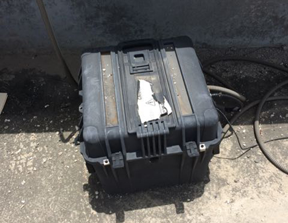
Old equipment enclosure for JME2, on the roof of the polic headquarters in the town of Jacmel in southern Haiti. (Photo/Mike Fend, UNAVCO) 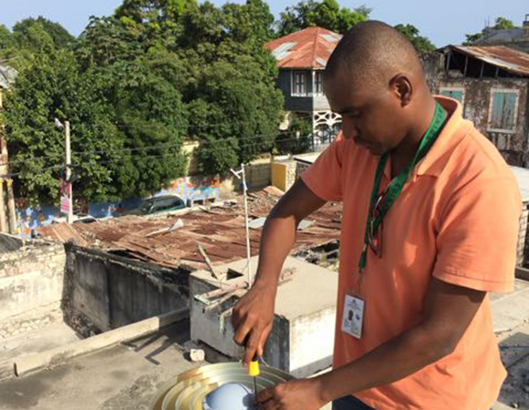
Renaldo Sauveur, (CNIGS), replaces the LMA on the GPS antenna of station JME2. (Photo/Mike Fend) 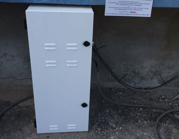
Newly installed equipment enclosure for JME2, on the roof of the polic headquarters in the town of Jacmel in southern Haiti. (Photo/Mike Fend, UNAVCO) 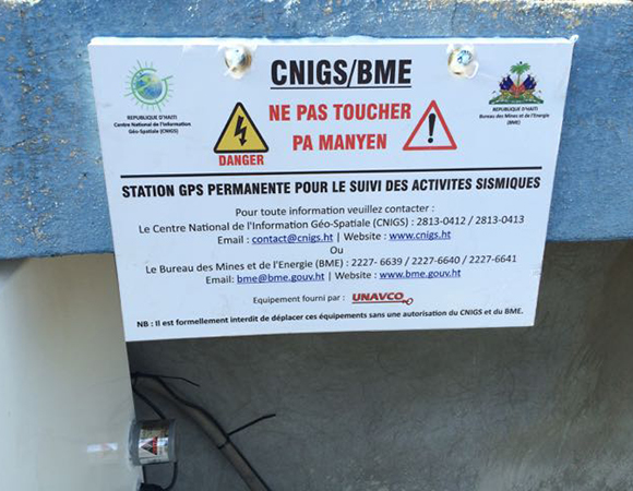
GPS station sign in Haiti to deter vandalism. (Photo/Mike Fend, UNAVCO) 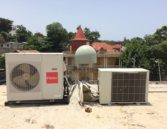
Encroachment of air conditioning units on the GPS antenna for JME2. (Photo/Mike Fend, UNAVCO) 
The road from Port-au-Prince to Cap-Haïtien. (Photo/Mike Fend, UNAVCO) 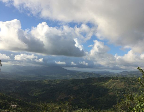
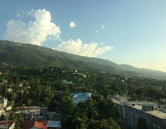
In transit north across Haiti from station JME2 in Jacmel to station CN09 in Cap-Haitien for station maintenance in Haiti in July, 2016. (Mike Fend, UNAVCO)
Project Overview
Determining how the Caribbean plate moves with respect to the neighboring North America and South America plates has been a major challenge. Geologic plate motion models using seafloor magnetic anomaly rates, transform fault azimuths, and slip vectors are challenging due to sparse data. The only rates come from the Cayman Spreading Center, and seismicity at the eastern boundary is low due to slow convergence. Moreover, the boundary geometry is still unclear, since the Caribbean plate’s north and south boundaries are complex deformation zones.
GPS data continues to provide key clues to the Caribbean region’s geologic faults. GPS stations are currently being installed as part of the Continuously Operating Caribbean GPS Observational Network (COCONet), strengthening the indispensible collection of data belonging to a region that faces many atmospheric and geologic natural hazards.
UNAVCO Connection
From July 10th through July 17th, Renaldo Sauveur and Dr. Steeve Symithe from the Central National de I’Information Géo-Spatiale (CNIGS) and UNAVCO field engineer Mike Fend worked to upgrade and restore communications for COCONet cGPS stations CN09 and JME2 in Haiti.
Sauveur and Fend first improved cGPS station JME2, on the roof of the police headquarters in the town of Jacmel in southern Haiti. The equipment, installed in a prototype enclosure almost three years ago, malfunctioned due to years of constant heat. The team replaced the old, black enclosure with the standard COCONet enclosure, which is white and includes improved ventilation, and secured the enclosure in protective shade. The station was also upgraded with a new receiver, LNA for the GPS antenna, and new cell modem.
Sauveur, Smythe, and Fend then traveled north across the island to the coastal town of Cap-Haïtien to similarly upgrade CN09 with a new enclosure, LNA for the GPS antenna, and reciver, and restore telemetry.
Upon the team’s return to Port-au-Prince, UNAVCO’s Fend trained CNIGS engineers on how to troubleshoot common and complex issues while servicing a GPS site.
Significance
The COCONet project was funded by the National Science Foundation (NSF) with the aim of developing a large-scale geodetic and atmospheric infrastructure in the Caribbean that will form the backbone for a broad range of geoscience and atmospheric investigations and enable research on process-oriented science questions with direct relevance to geohazards. The Caribbean Plate is a unique opportunity to monitor movement, because most of the plate rests underwater. Prior to this endeavor there has been limited monitoring of the Caribbean Plate. Furthermore, each site is equipped with a weather station which records vital atmospheric data that is analyzed by our friends at the University Corporation for Atmospheric Research (UCAR) to monitor the movement of potentially deadly hurricanes.
Project Information
- Principal Investigators: COCONet
- UNAVCO Engineer(s): Mike Fend
- Dates: July 10 – 17, 2016
- Location(s): Jacmel and Cap-Haïtien, Haiti
- Funding Source: NSF, COCONet
- Map of Haiti
Related Links
Written by:
- Mike Fend
- Posted: 29 August 2016
- Last updated: 23 June 2021
- Tags: COCONet, GPS, project highlights
-

