For current news content, please visit EarthScope.org.

Home

Filter

Showing 157 - 168 of 171 posts

12 Feb 2013

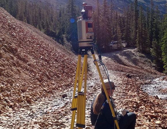
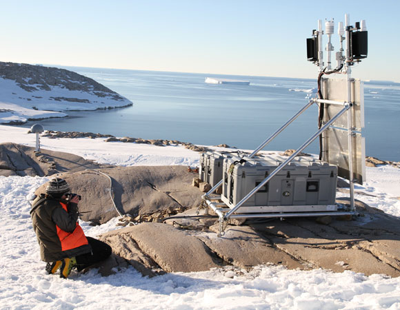
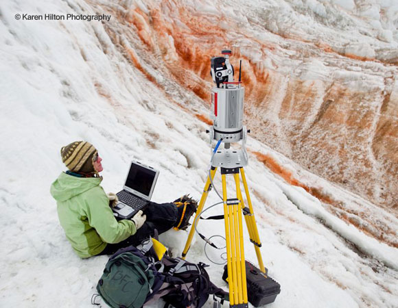
UNAVCO uses Terrestrial Laser Scanning (TLS) to examine bluff beneath 12th century castle

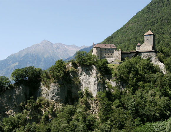
Project Overview In the Burggrafenamt district of South Tirol, Italy, a castle sits on a hill, named by the ancestral seat of the Counts of Tirol during the 12th century. The castle has witnessed a range of historical events, through the Habsburg dynasty, the Napoleonic Wars, two world wars, and now embodies its modern role … Continued

12 Feb 2013

Terrestrial Laser Scan (TLS) of Handcart Gulch explores rock glaciers

Project Overview Handcart Gulch, named for the handcarts that Colorado miners used to pull outfits up the steep valley, was a rowdy area that reached its peak in 1876-77 with several hundred miners in the area. Today, only some ruins mark the site. It is also the site of a terrestrial laser scanning project that … Continued

4 Feb 2013

RAPID: Nicoya Earthquake After-event Response (NEAR) 2012

Project Overview Megathrust earthquakes occur at subduction zones at convergent boundaries, where one tectonic plate is subducted by another. These earthquakes are among the most powerful and destructive natural hazards on the planet. Over 250,000 people were killed by the 2004 Indian Ocean tsunami generated by the Sumatra-Andaman megathrust earthquake. These events are devastating, not … Continued

14 Jan 2013

Delving into the East African Rift System in Three Dimensions

Project Overview During July of 2012, 10 new continuous GPS stations were installed around the Lake Malawi region. Lake Malawi is the southernmost lake in the East African Rift system, located between Malawi, Mozambique, and Tanzania. The third largest and second deepest lake in Africa, it is also the ninth largest in the world. Working … Continued

9 Jan 2013

Exploring arc volcano processes with the Soufriere Hills Volcano, Montserrat

Project Overview In April of 2012, two engineers from UNAVCO conducted a maintenance trip to the Island of Montserrat to service four stations that house continuous GPS systems and borehole strain meters. These four stations were originally installed on the island between 2002 and 2004 as part of the Caribbean Andesite Lava Island Precision Seismo-geodetic Observatory … Continued

11 Dec 2012

Improving Our Understanding of Carbon Sequestration Monitoring with GPS

Project Overview Tim Dixon of the University of South Florida is working to develop a new, integrated approach for monitoring, verification, and accounting of carbon dioxide (CO2) sequestered in deep geologic repositories. Interest in terrestrial carbon sequestration has increased in an effort to explore opportunities for climate change mitigation. In October of 2011, three continuously … Continued

16 Nov 2012

The BanglaPIRE Project

Project Overview Three of the world’s largest rivers, the Ganges, the Brahmaputra, and the Meghna, converge in the country of Bangladesh and dump one gigaton of sediment there annually to form the world’s largest delta (The Ganges-Brahmaputra-Meghna Delta, or GBMD). This delta overlies the rapidly subsiding junction of three tectonic plates. Significance Almost 160 million … Continued

16 Nov 2012

COCONet GPS Network Expansion: Colombia

Project Overview COCONet (Continuously Operating Caribbean GPS Observational Network) is an NSF sponsored project with over 35 participating institutions from South, Central, and North America. COCONet will establish a network of over 50 new continuous GPS (cGPS) and meteorology stations, refurbish an additional 21 stations, and archive data from more than 60 cGPS stations that … Continued

19 Jul 2012

Installation of 2 deep drilled-braced monuments The Goddard Geophysical and Astronomical Observatory

Project Overview In 2011, a collaborative NASA-funded Space Geodesy Project was initiated. Jointly operated by the NASA Goddard Space Flight Center and Jet Propulsion Laboratories, the project is focused on constructing, operating, and maintaining a NASA Space Geodetic Network (NSGN) of integrated, multi-technique next generation space geodetic observing systems. This new NSGN will serve as … Continued

19 Jul 2012

Nicoya Peninsula continuous GPS network telemetry upgrades and COCONet network expansion

Project Overview The Nicoya Peninsula continuous GPS network consists of 18 remote sites distributed mostly in the forearc of the Cocos subduction zone in northwest Costa Rica. The network is designed to measure transient surface deformation above the seismogenic plate-boundary interface. The network was established and expanded in several stages beginning in 2006. Many of … Continued

19 Jul 2012

The Polar Earth Observing Network (POLENET) 2011/2012 Field Season

Project Overview The POLENET (Polar Earth Observing Network) project focuses on collecting GPS and seismic data from autonomous systems deployed at remote sites spanning much of the Antarctic and Greenland ice sheets. GPS and seismic measurements together provide a means to answer critical questions about ice sheet behavior. Determining the vertical and horizontal velocity fields … Continued

19 Jul 2012

2011-12 Antarctic Season Highlights

Project Overview UNAVCO provides geodetic support to NSF-OPP funded scientific investigators working in the Arctic and Antarctic. Survey grade GPS receivers, terrestrial laser scanners, and supporting power and communications systems for continuous data collection and campaign surveying are available. Operation and maintenance services are also provided for long term data collection, with on-line data distribution … Continued