
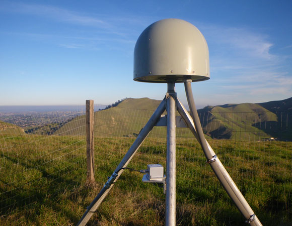
EarthScope Plate Boundary Observatory station P248, Black Diamond, with an accelerometer mounted on the center post of the GPS antenna monument. (Photo by Doerte Mann, UNAVCO) 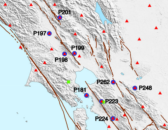
Location of the 10 sites with newly installed accelerometers in the San Francisco Bay area (blue circles). (Map by Doerte Mann, UNAVCO) 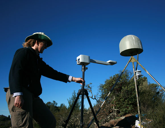
PBO field engineer Doerte Mann uses a GPS-based compass, on loan from Scripps, to align the accelerometer to north at P201. (Photo by Christian Walls, UNAVCO) 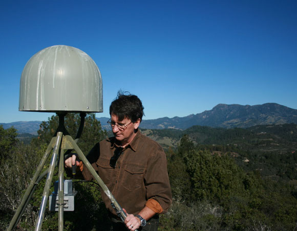
PBO southwest GPS regional manager Christian Walls levels the accelerometer at P201. (Photo by Doerte Mann) 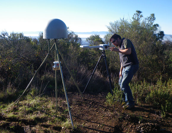
PBO field engineer Ryan Turner uses a GPS-based compass to align the accelerometer to north at P224. (Photo by Doerte Mann, UNAVCO) 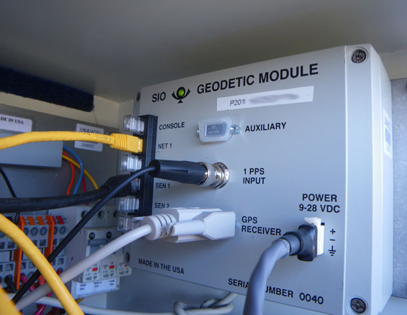
The Geodetic Module, developed at Scripps Oceanographic Institute. (Photo by Doerte Mann, UNAVCO). 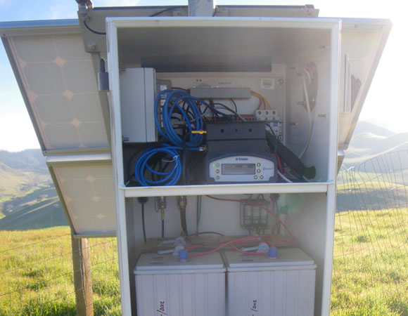
The Geodetic Module is mounted inside the enclosure (here, on the top left), together with upgraded GPS receiver and cell modem. (Photo by Doerte Mann, UNAVCO)
Project Overview
Between December 2014 and February 2015, UNAVCO installed 10 accelerometers at existing Plate Boundary Observatory (PBO) GPS sites in the San Francisco Bay Area. Accelerometers in combination with high-precision GPS data provide a new interdisciplinary data type: full spectrum displacements based on an optimal combination of geodetic and seismic data. These can significantly improve finite fault slip modeling through full waveform inversion of the earthquake source. Applied in real-time, this information is an essential input in models for prototype earthquake early warning systems. The instruments are low-cost MEMS (micro-electro-mechanical system) accelerometers, designed at the Scripps Institution for Oceanography. Tests with shake tables indicate that the low-cost instruments are interchangeable with more expensive observatory-grade instruments in boreholes.
This network upgrade follows a similar upgrade of 12 PBO sites in Southern California, in a joint project between UNAVCO and Scripps.
Locations in the San Francisco Bay area
The 10 sites in the Bay Area were selected with input from the science community, based on site location with respect to major faults and to fill gaps in real-time monitoring coverage of combined GPS and seismic data.
- Four sites are along the Rodgers Creek Fault (P197, P198, P199, P201) extend coverage to the Northbay.
- Two sites near the Concord and Greenville Faults (P248, P262) provide new coverage in this area.
- Three sites on either side of the Hayward Fault (P181, P223, P224) augment existing coverage.
- One site along the San Andreas Fault (P176) plants a seed for future expansion in this area.
Installation
The accelerometer is attached to the vertical leg of the GPS monument and aligned to true north. A data cable connects it to the Geodetic Module (GM) located inside the GPS equipment enclosure. The seismic data are sampled at 100 Hz. Currently, combined seismogeodetic data are analyzed at a computer away from the station, but in next-generation systems, the Geodetic Module will perform the waveform analysis directly at the station.
All 10 sites were also upgraded to GNSS-capable antennas and NetR9 receivers, and are streaming GPS and accelerometer data in real-time. GPS and accelerometer streams are routed to Boulder and are publicly available from the UNAVCO data archive.
Why Co-locate
Seismometers and GPS each provide data that are critical for earthquake early warning. Seismometers, with very high-rate and high-frequency data capture, are good for recognizing and locating earthquakes, and determining magnitude if the earthquake is small to moderate in size (Mw < 7). GPS measures the lower frequency motions of static offsets (how much the ground moves as a result of the earthquake, without moving back), yield a clear picture of the extent of the rupture and are good for determing earthquake magnitude and extent, especially for large events (Mw > 7). Together, seismometers and GPS can quickly yield earthquake occurance, location, magnitude, and extent. This information is crutial in providing warnings of when, where, and how intensly shaking will occur.
Project Information
- Major Project: Plate Boundary Observatory
- UNAVCO staff: Southwest Regional PBO staff (Andre Basset, Christian Walls, Doerte Mann, Ryan Turner, Shawn Lawrence)
- Dates: December 2014 – February 2015
- Location(s): San Francisco Bay area
- Funding Source: NSF
- Map of San Francisco Bay, CA
Related Links
Written by:
- Doerte Mann and Beth Bartel
- Posted: 30 March 2015
- Last updated: 25 June 2021
- Tags: GPS/GNSS, project highlights
-

