Students are able to explain the relationships between earthquakes, volcanoes, and plate boundaries in the western United States and Alaska.
This activity was developed for middle school and high school students, grades 6 - 12. However, its focus on data makes it adaptable for introductory college courses.
One class sessions (45 - 55 minutes) or homework.
Students should be familiar with using the internet.
This activity can be used at any time in an earth science class. However, in the sequence of lessons about plate tectonics, it is an optional activity to use data to learn about plate tectonics
Performance Expectations: MS-ESS3-2, and HS-ESS1-5.
Students will be able to:
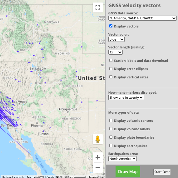
Learners use the UNAVCO GPS Velocity Viewer, or the included map packet to visualize relationships between earthquakes, volcanoes, and plate boundaries as a jigsaw activity.
This activity consists of four parts:
Individual files:
8 MB • v: August 2016
Student Worksheet Western United States [pdf]
8 MB • v: August 2016
Western United States blank map [pdf]
2 MB • v: August 2014
Presentation: Alaska: Visualizing Relationships Between Earthquakes, Volcanoes, and Plate Tectonics [pptx]
24 MB • v: March 2017
Student Worksheet Alaska [pdf]
2 MB • v: March 2017
Individual maps with earthquake locations, volcano locations, velocity vectors, and blank map [pdf]
2 MB • v: August 2014
Funding for this unit came from the Plate Boundary Observatory, NSF, NASA, the American Recovery and Reinvestment Act, and UNAVCO. Authors are Roger Groom (Mt. Tabor Middle School), Cate Fox-Lent (UNAVCO), Shelley Olds (UNAVCO), and Nancy West (Quarter Dome Consulting).
Last modified: 2020-04-16 04:16:32 America/Denver