Education Help with Education Education Resources UNAVCO Educator Packet Field Geodesy Learning Modules & Activities Majors-level undergraduate Introductory-level undergraduate Secondary- Grades 6-12 Data for Educators Tutorials & Handouts GPS Tutorials 3D Imaging Tutorials Geodesy Education Handouts & KMZs Lab Book Links

Exploring Tectonic Motions using GPS Velocity Maps of Alaska, Western United States, & Around the World | Lessons on Plate Tectonics


Index


Goal

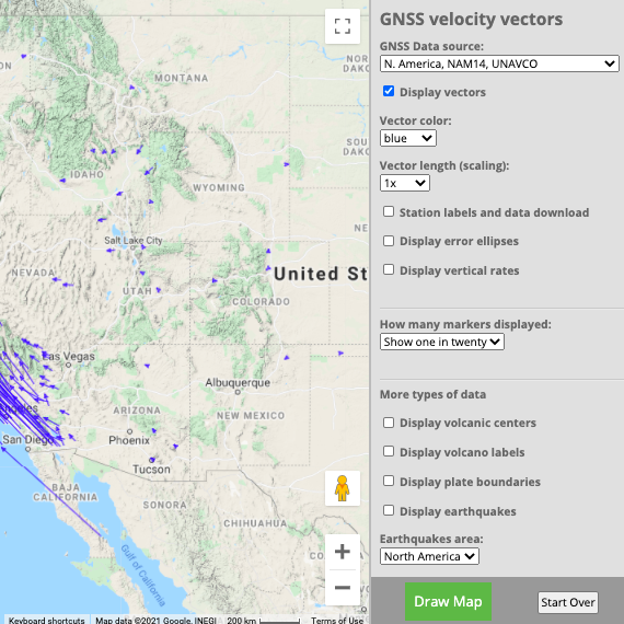
Using maps showing the horizontal velocities of GPS stations in the Plate Boundary Observatory and other GPS networks in Alaska, Western United States, and regions around the world, students are able to describe the motions in different regions by interpreting the vectors resulting from long-term high-precision Global Positioning System (GPS) data.


Context

Audience

This activity was developed for middle school and high school students, grades 6 - 12. However, its focus on data makes it adaptable for introductory college courses.

Teaching Time

One class session (45 - 55 minutes) or homework.

Skills and concepts that students must have mastered

Students should be able to read maps and understand map scale.

How the lesson is
situated in the course

This activity can be used at any time in an earth science class particularly with in a sequence of lessons about plate tectonics. It can be used as an introductory activity for students to explore current plate motions and to learn about compression, extension, and horizontal slip.

Next Generation Science Standards

Performance Expectations: MS-ESS3-2, and HS-ESS1-5.

Objectives

Students will be able to:

  • Describe how velocity vectors from GPS stations inform us about tectonic motion and plate boundaries.
  • Describe and draw a velocity vector
  • Analyze and describe regional plate motion data as represented as vectors.
  • Interpret crustal deformation based on velocity vector map.
  • Identify, discuss and defend the locations they chose that are most likely to have earthquakes.

Summary

Students analyze data from GPS data represented as vectors on maps of Alaska, western United States, and regions around the world to study tectonic motions at plate boundaries and within the North American and Pacific tectonic plates. Students discover the types of motions and plate boundaries. By observing the patterns of vector lengths and directions, students interpret the motion within multiple regions:

  • Pacific Northwest (Washington / Oregon / Northern California region)
  • Basin & Range (Nevada / Utah region)
  • California
  • Alaska
  • Japan and Western Pacific
  • Mid-Atlantic ridge
  • India and Eurasia
  • East Africa
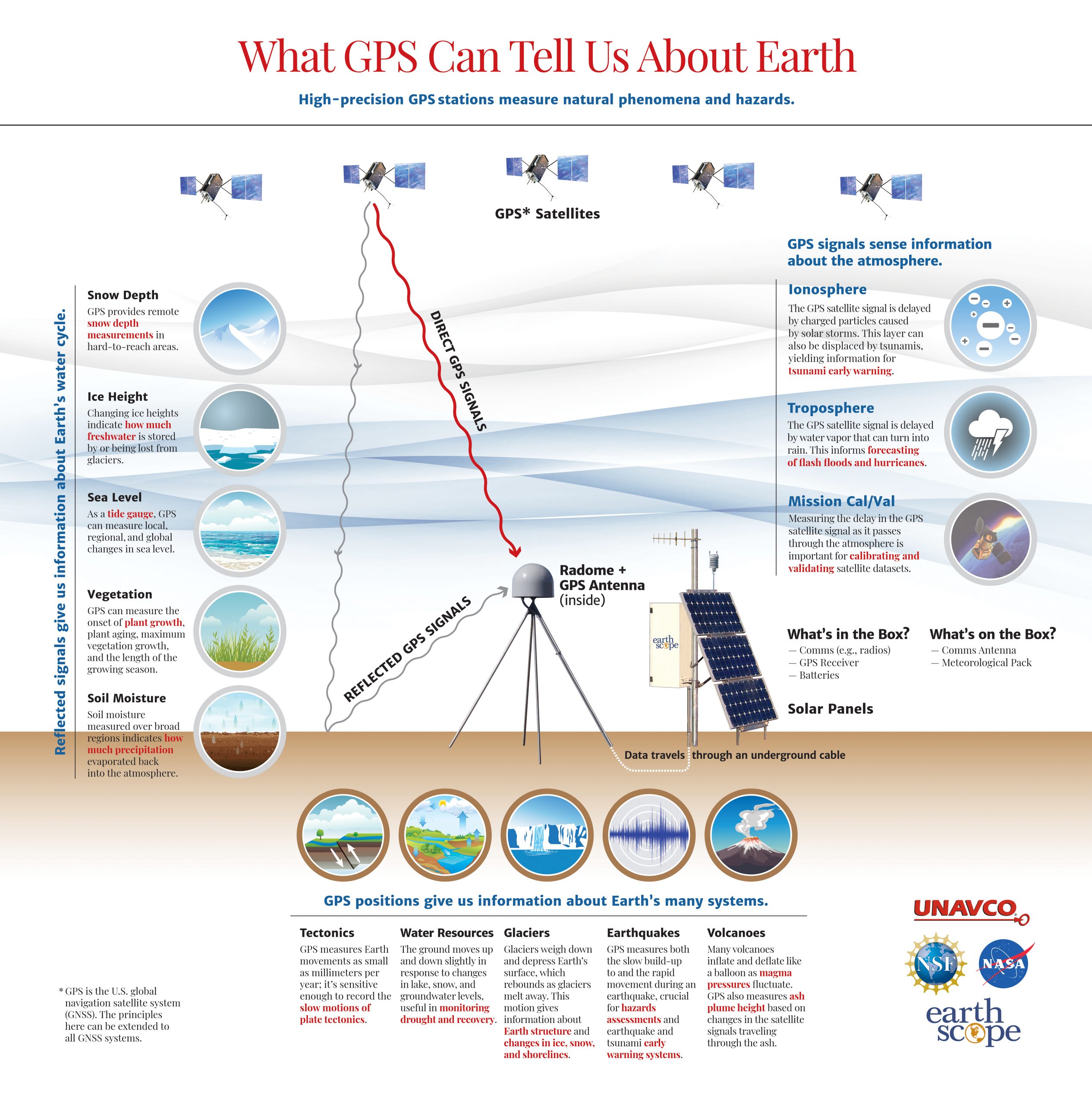
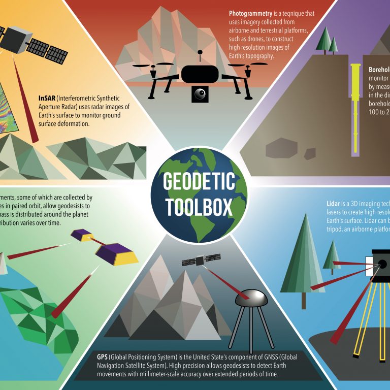
To synthesize their findings, students identify locations most likely to have earthquakes. Students need to be able to defend their choices by providing evidence based on the tectonic motions from the map/poster, earthquake data, and seismic hazards. Optionally, students begin the activity by learning about geodesy and GPS and study a physical demonstration to understand the architecture of GPS, from satellites to sensitive stations on the ground.

More about the Velocity Map Posters [html]


Materials & Online Tools


Online tools

GPS Velocity Viewer


Regions Around the World

Regions around the World Student Worksheet

[pdf] [docx]

7 MB • v: April 2019


Western United States

Western United States Student Worksheet

[pdf] [docx]

6 MB • v: April 2019


Seismic Hazard Map of Conterminous United States

[pdf]


Map: Tectonic Motions of the Western United States

8.5 x 11-inch version [pdf]

5 MB • v: August 2016


Alaska

Alaska Student Worksheet

[pdf] [docx]

5 MB • v: April 2019


Alaska Seismic Hazard Map

[pdf]

1 MB • v: May 2017


Map: Tectonic Motions of Alaska

[pdf]

1 MB • v: May 2017


Module Development

This work is based on materials provided by the UNAVCO Education and Community Engagement Program, and the GAGE Facility supported by the National Science Foundation (NSF) and National Aeronautics and Space Administration (NASA) under NSF award: EAR 1261833. Activity author: Shelley Olds; Poster authors: Beth Bartel, Christine Puskas, and additional UNAVCO staff.

Send questions or comments about this page to education –at- UNAVCO.org


Last modified: 2020-04-16  04:16:32  America/Denver