Education Help with Education Education Resources UNAVCO Educator Packet Field Geodesy Learning Modules & Activities Majors-level undergraduate Introductory-level undergraduate Secondary- Grades 6-12 Data for Educators Tutorials & Handouts GPS Tutorials 3D Imaging Tutorials Geodesy Education Handouts & KMZs Lab Book Links

Modules and Activities


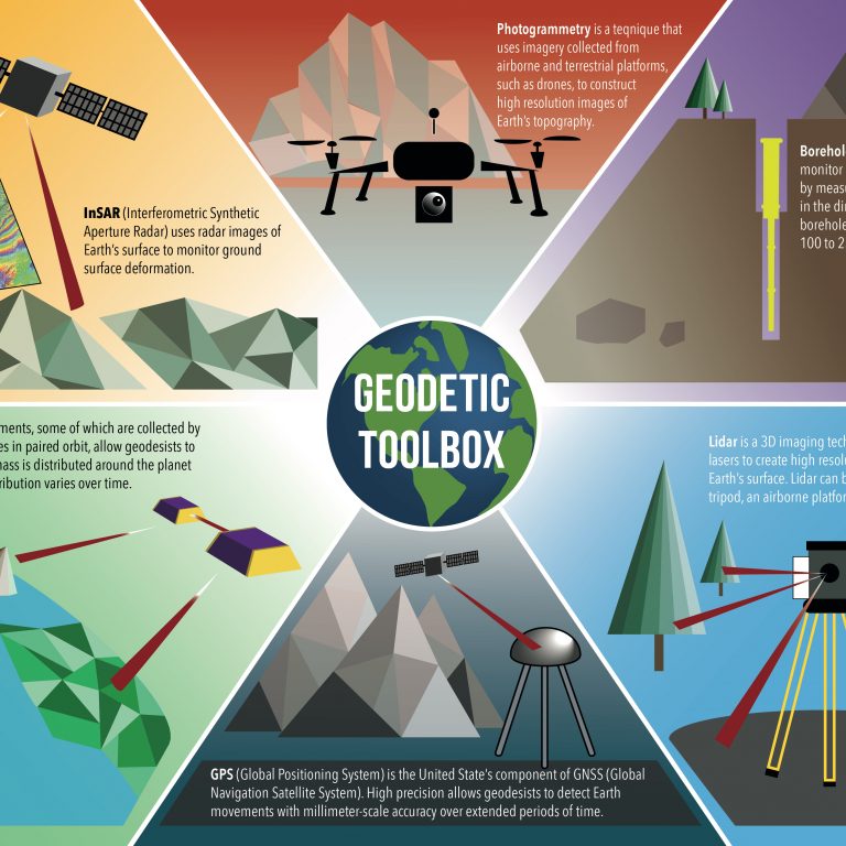
Integrating the applications of geodesy into the secondary and undergraduate curriculum broadens students' exposure to modern measurement techniques such as global positioning system (GPS), airborne or terrestrial lidar (TLS), and gravity. Scientists use geodesy as an approach to understand the changing face of our planet to study plate motion, sea level changes, Earthquakes, glacial movement and isostatic changes, volcanic deformation, landslides, glaciers, vegetation change, subsidence, soil moisture, precipitable water vapor, the water cycle, and more.

Modules and Activities use geodesy as an approach to understand the changing face of our planet. They are organized by the intended learning level of the resource. In many cases, the resources can be used in more advanced or novice levels with simple modifications.

  • Majors-level Undergraduate

    Designed for undergraduate majors level courses to fit within geology & Earth system science, environmental science, meteorology, oceanography, geological hazards, global change courses. Resources included in the GETSI (GEodesy Tools for Societal Issues) collection are noted below. UNAVCO is the lead institution on the collaborative grants that have funded the GETSI project.

    • Description

      Important links
    • High Precision Positioning with Static and Kinematic GPS/GNSS
      Majors-level module for field methods, structural geology, or geomorphology courses. Part of the GETSI collection.

      In this module, students will learn the fundamentals of global navigation satellite systems (GNSS, a more universal term than GPS) and how to apply these techniques beyond answering, "Where am I?" This module teaches how high-precision positioning enables geoscientists to track changes in the surface of the earth that would otherwise be imperceptible. Through brief classroom lectures, demonstrations, and field exercises, students learn both kinematic and static positioning techniques. This module is field-focused, minimizing lectures and computer work and maximizing student time spent designing and implementing surveys as well as analyzing the new data. Most units require half to a full day to execute, although some waiting time may be required for post-processing satellite data.

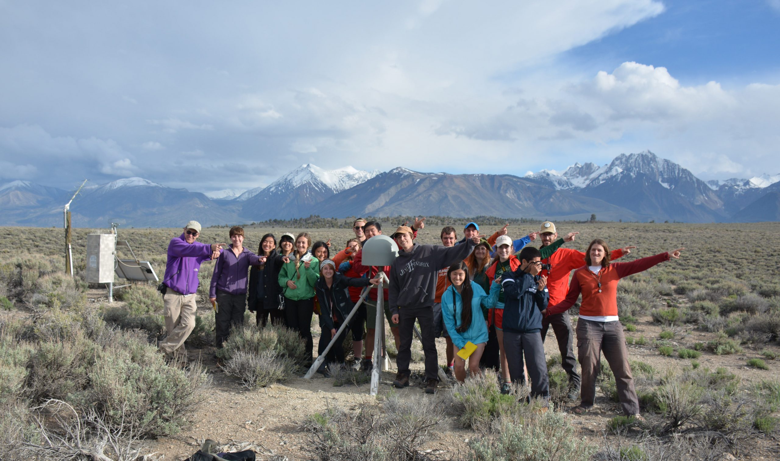
      Students in the field conducting a GPS survey.
    • Measuring Water Resources with GPS, Gravity, and Traditional Methods
      Majors-level module for hydrogeology or environmental science courses. Part of the GETSI collection.

      Measuring water resources such as groundwater and snowpack is challenging, but the advent of satellite gravity measurements and hydrologic GPS applications can augment traditional methods. This module gives students the unique opportunity to learn these newer methods alongside more traditional ones of groundwater wells and SNOTEL stations. They determine the pros/cons, uncertainty, and spatial scales of different methods. Droughts in the High Plains Aquifer and California are used as case studies. In the summative assessment, students pull together what they have learned and write a report with recommendations for policy makers.

      Google Earth image of the Willow Creek watershed. From the GETSI website.
    • Imaging active tectonics with InSAR and LiDAR
      Majors-level module for structural geology or geophysics courses. Part of the GETSI collection.

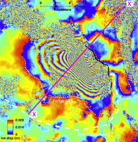
      In this module, students use LiDAR and InSAR data to understand the earthquake cycle, from individual earthquakes to landscape-forming timescales. This is motivated by consideration of earthquake hazards, specifically the vulnerability of the infrastructural lifelines upon which society depends. Five units are provided, including lecture materials, discussions, paper exercises, group activities that can be deployed either as gallery walks or computer exercises, an exercise for modeling InSAR data using an online tool, and a culminating assignment. These materials are intended for inclusion in upper-level undergraduate classes in structural geology, tectonics or geophysics.

      Interferogram of the Dinar, Turkey 1995 earthquake. InSAR allows for the measurement of topographic change over a broad area. Data processed by Gareth Funning.
    • Analyzing High Resolution Topography with TLS and SfM
      Majors-level module for field methods, structural geology, or geophysics courses. Part of the GETSI Field Collection.

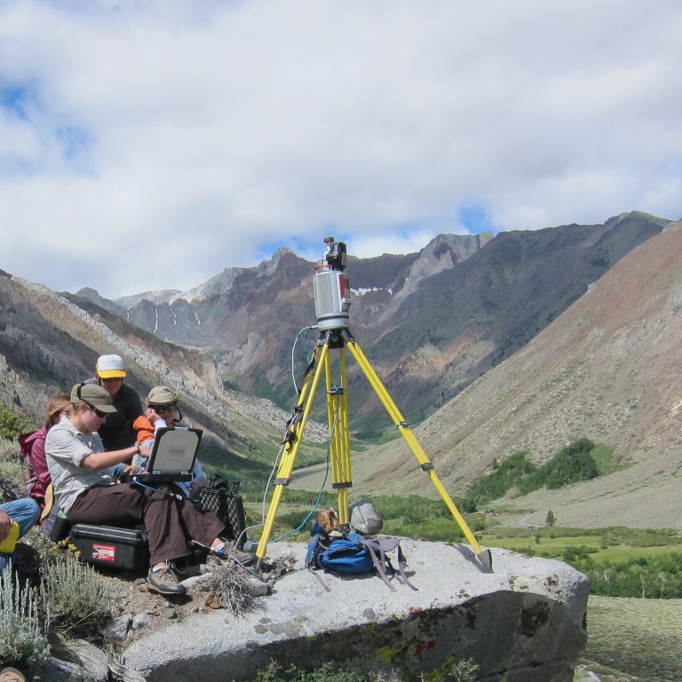
      This module is designed for a geoscience field camp in which students learn to conduct a terrestrial laser scanner (TLS) survey to address real field research questions and to learn about other geodetic imaging technologies such as structure from motion (SfM) and terrestrial radar). During the module, students move from learning the basics of equipment set up and survey design to being able to apply the TLS technique to geoscience field investigations and larger societally importance questions that can be addressed.

      Students on the University of California Davis field camp conduct a TLS survey to determine post-fire changes.
    • GPS, Strain, and Earthquakes
      Majors-level module for structural geology or geophysics courses. Part of the GETSI collection.

      This module introduces geoscience majors to using EarthScope Plate Boundary Observatory GPS data to study infinitesimal strain, measure how this deformation (strain) occurs, and connect strain to broader tectonic settings and hazards such as earthquakes. This module is applicable to a variety of geoscience disciplines, including structural geology, tectonics, and hazards assessment (earthquake, volcano, landslide).

      map of Cascadia showing tectonic motions
    • GPS Undergraduate and Graduate Courses Taught by UNAVCO Community Members

      These courses introduce the principles of the Global Positioning System and Global Navigation Satellite Systems, fundamentals, and applications.

  • Introductory Level Undergraduate

    These resources have been successfully used in grades 6 - 12 with modifications.

    • Description

      Important links
    • Surface Process Hazards
      Part of the GETSI collection.

      Worldwide mass wasting causes hundreds if not thousands of deaths per year and billions of dollars in damages. Many of these losses would be preventable if societies prioritized landslide mitigation. In this 2-3 week module, students use a variety of geodetic and other data to analyze the natural and human characteristics of landscapes that contribute to mass wasting hazards. Most of the geodetic data sets are high resolution topography from Lidar and radar, but some InSAR data are also included. Students consider the environmental and societal impacts of mass wasting and landslides as well as the physical factors behind mass movements. Materials for student reading and preparation exercises, in-class discussions, lab exercises, small group activities, gallery walks, and a final project are provided, as well as teaching tips and suggestions for modifications for a variety of class formats. Case study sites include Peru, Italy, and a variety of North American sites from Alaska to Utah to New York.

      Aerial view of a mudslide in Washington State.
    • Ice mass and sea level changes
      Part of the GETSI collection.

      In this 2-3 week module, students interpret geodetic data from Greenland to assess spatial patterns and magnitudes of ice mass change and consider mechanisms and timescales for ice mass loss. They also investigate the relationship between ice mass change and global and regional sea level, with an emphasis on the ongoing and future implications of sea level change on civilization. Materials for student reading and preparation exercises, in-class discussions, lab exercises, small group activities, gallery walks, and wall walks are provided, as well as teaching tips and suggestions for modifications for a variety of class formats.

      ---
    • Earth Exploration Toolbook Chapter: Analyzing Plate Motion Using EarthScope GPS Data
      Appropriate for lower undergraduate and high school courses in Earth Science and Geology

      In this EET chapter, students will access Global Positioning System (GPS) data from the EarthScope Plate Boundary Observatory (PBO) and analyze the data in a spreadsheet to measure the motion of GPS stations in the Pacific Northwest. From the analyses, students will generate and map annual velocity vectors of GPS stations then explore patterns in the direction and length of velocity vectors on the map to understand tectonic motion and surface deformation associated with the subduction of the Juan de Fuca plate under the North American plate.

      Image of two vectors being added together
    • Taking the Pulse of Yellowstone's "Breathing" Volcano
      Intended for introductory level Earth science course such as physical geology, environmental geology, geological hazards, or geology of national parks.

      Students learn about volcanism in Yellowstone National Park, focusing on its history of eruption, recent seismicity, hydrothermal events, and ground deformation. They learn how scientists monitor volcanoes (using Mount St. Helens as an example) and then apply that as an open-ended problem to Yellowstone; their problem is to identify a site for a research station.

      graphs of vertical changes through time in Yellowstone
    • Detecting Motion in Cascadia with GPS
      One-class exercise; Intended for introductory level Earth science courses

      Designed as a large class (50+) introductory undergraduate exercise. Students work in teams of 4 to analyze GPS data to determine regional plate motion in the Cascadia (Pacific Northwest) region using GPS time series plots.

      --
    • GPS Data and Earthquake Hazards in Cascadia
      One-class exercise; Intended for introductory level Earth science courses

      Designed as a large class (50+) exercise. Students learn to read GPS time series plots and apply that knowledge to evaluating the earthquake hazard in Cascadia. By investigating how the velocity of different areas change compared to other areas of the Pacific northwest, students learn about strain and how to tie these to regional geology and ongoing hazards.

      map of Cascadia showing tectonic motions
  • Secondary, Grades 6 - 12, Middle and High School

    While these resources have been used in middle school and high school, they have been successfully implemented in Introductory Undergraduate with minor modifications.

    • Description

      Important links
    • Exploring tectonic motions using GPS velocity maps

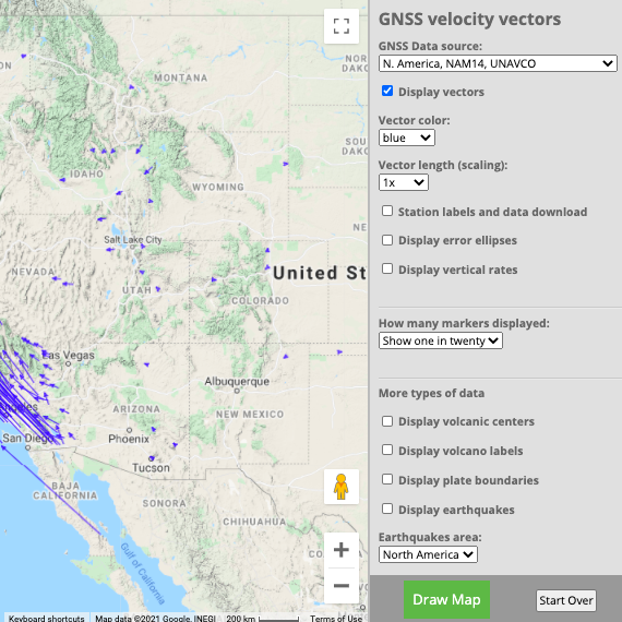
      Students use their observational and pattern recognicition skills to discover the tectonic motions of Alaska, the western United States, and/or regions around the world by exploring the UNAVCO Tectonic Motions posters and the UNAVCO Velocity Viewer.

      Tectonic motions of the western United States as expressed by vectors.
    • Measuring plate motion with GPS: Iceland

      In this lesson, students learn to interpret GPS data collected from permanentaly installed high-precision GPS stations in Iceland. They analyze time series plots of the data as the station’s position moves over time in the north-south and east-west directions. Students learn how to represent time series data as velocity vectors and how to graphically add the vectors to create a total horizontal velocity vector. They apply their skills to calculate the direction and speed of motion for two GPS stations.

      Lava flow
      • Activity page [html]
      • Full zip-file of all presentations, worksheets, and documents [zip]
    • Exploring plate motion and deformation in California with GPS

      Students analyze GPS data to study the motion of the Pacific and North American tectonic plates. From this data, students detect relative motion between the plates in the San Andreas fault zone--with and without earthquakes. They interpret time series plots from an earthquake in Parkfield, CA to calculate resulting slip on the fault and (optionally) the earthquake’s magnitude.

      map of Cascadia showing tectonic motions
      • Activity page [html]
      • Full zip-file of all presentations, worksheets, and documents [zip]
    • Module: Taking the pulse of Yellowstone’s “breathing” volcano: Problem-based learning in America’s first national park

      In this module, students learn about volcanism in Yellowstone National Park by focusing on its signs of volcanic activity: its history of eruption, recent seismicity, hydrothermal events, and ground deformation. They learn how scientists monitor volcanoes (using Mount St. Helens as an example) and then apply that as an open-ended problem to Yellowstone by identifying a site for a hypothetical research station.

      map of Yellowstone and high-resolution topography imaged from LiDAR.
      • Activity page [html]
      • Animation of Yellowstone's inflation and deflation 2004 - 2011 as measured by PBO GPS [youtube]
      • Full zip-file of all presentations, worksheets, and documents [zip]
    • Module: Detecting Cascadia’s Changing Shape with GPS

      Students learn about deformation and that as segments of the crust move, rotate, and change shape (distort) under the influence of plate tectonics, the land is deformed (“strain”). They analyze data measuring crustal processes that escalate towards earthquakes and other seismic events. The module teaches about great earthquakes and resulting tsunamis. It has a special focus, though, on GPS data that show Cascadia gradually deforming—until the next great quake (Mw 8.5 or greater) occurs.

      photo of a dynamic mask from the Swai’xwe tribe, British Columbia representing natural shaking—of the ground and atmosphere.  Ludwin, Ruth S. 2008.   “Pacific Northwest Earthquakes:  Evidence in Native Myth and Tradition.”
    • A 3d View from a Drone: Make a 3d model from your photos

      In this activity, you guide the students to identify an outcrop or landform to study later or over repeat visits. They go through the process to plan, conduct, and analyze an investigation to help answer their science question.

      The Challenge: Design and conduct an experiment to take enough photos to make a 3-dimensional image of an outcrop or landform, then analyze the image and interpret the resulting 3-d image.

      Photo of an outcrop overlaying a point cloud of data. A point cloud is a series of data points that have been plotted in a 3-dimensional coordinate system.
    • Visualizing relationships with data: Exploring plate boundaries with earthquakes, volcanoes, and GPS data in the western U.S. using EarthScope Voyager Jr.

      Learners use the web-based data viewing tool, EarthScope Jr., or the included map packet to visualize relationships between earthquakes, volcanoes, and plate boundaries in the western United States.

      map of EarthScope Voyager Jr.
      • Activity page [html]
      • Full zip-file of all presentations, worksheets, and documents [zip]
    • Episodic tremor and slip: The case of the mystery earthquakes

      Students study seismic and GPS data from the Pacific Northwest region of the United States to recognize a pattern in which unusual tremors--with no surface earthquakes--coincide with jumps of GPS stations. Students model ductile and brittle behavior of the crust and assemble their knowledge of the data and models into an understanding of episodic tremor and slip (ETS) in subduction zones and its relevance to the millions of residents in Cascadia.

      map of Cascadia showing tectonic motions
      • Activity page [html]
      • Full zip-file of all presentations, worksheets, and documents [zip]
    • Introduction to graphing GPS data

      Designed as a prequel for students who cannot yet graph earth science data skillfully or confidently, this activity guides students to making sense of graphed data and emphasizes making graphs—in order to learn how to interpret graphs. Students graph data measuring how the position of GPS stations move over time, north or south and east or west. By hand-drawing these graphs, students gain skills needed to understand “time series” graphs published online.

      map of Cascadia showing tectonic motions
      • Activity page [html]
      • Full zip-file of all presentations, worksheets, and documents [zip]
 

Last modified: 2019-12-24  01:25:34  America/Denver