
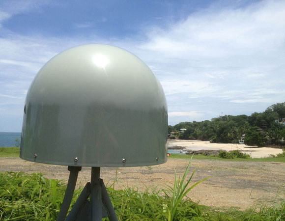
COCONet GPS site CN28 on Contadora Island. Photo provided by Mike Fend 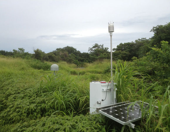
COCONet GPS site CN28 on Contadora Island. Fast-growing vegetation threatens to take over the solar panels. Photo provided by Mike Fend 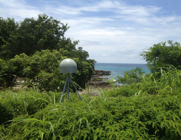
COCONet GPS site CN28 on Contadora Island. Just beyond the site, the land drops away to the Pacific ocean. Photo provided by Mike Fend. 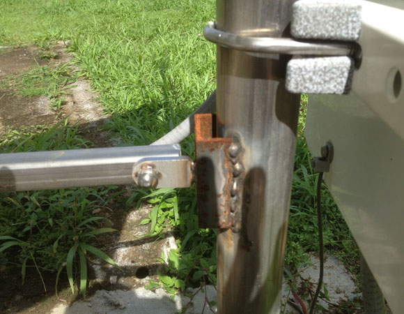
Only two months after installation, rust is already a problem on the enclosure post of CN20. Photo provided by Mike Fend 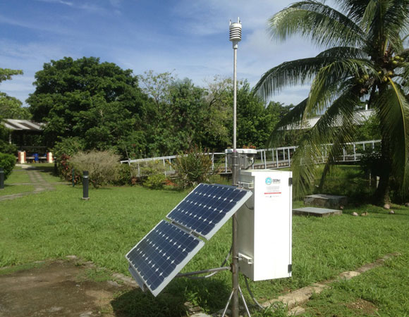
GPS site CN20 in the Smithsonian Tropical Research Institute on Bocas Del Toro Island, before site maintenance. 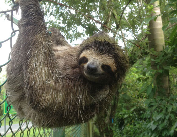
A sloth hangs out, literally, on a fence alongside GPS site CN20 in the Smithsonian Tropical Research Institute on Bocas del Toro Island.
Project Overview
Determining how the Caribbean plate moves with respect to the neighboring North America and South America plates has been a major challenge. Geologic plate motion models using seafloor magnetic anomaly rates, transform fault azimuths, and slip vectors are challenging due to sparse data. The only rates come from the Cayman Spreading Center, and seismicity at the eastern boundary is low due to slow convergence. Moreover, the boundary geometry is still unclear, since the Caribbean plate’s north and south boundaries are complex deformation zones.
GPS data continues to provide key clues to the Caribbean region’s geologic faults. GPS stations are currently being installed as part of the Continuously Operating Caribbean GPS Observational Network (COCONet), strengthening the indispensible collection of data belonging to a region that faces many atmospheric and geologic natural hazards.
UNAVCO Connection
UNAVCO engineer Mike Fend worked with collaborators to bring Panama sites CN20 and CN28 back online.
The first stop was CN28 on Contadora Island, located about 30 miles off the coast from Panama City, Panama, in the Pacific Ocean. Troubleshooting involved determining why the cellular modem stopped pushing data to UNAVCO servers. The culprit was the pay-as-you-go SIM card, which needed reactivation every month. Collaboration with Arkin Tapia, Nestor Vergara, and Eduardo Camacho at the Instituto de Geociencias in Panama City, Panama, resulted in a new contract with a local cell provider, and a new SIM card for the cellular modem.
Fend then headed north to the Caribbean side of Panama, to the Smithsonian Tropical Research Institute on Bocas del Toro Island. While the reserve is best known for ecological research, data from site CN20 feeds into research on regional tectonics. As at CN28, Fend was tasked with troubleshooting site communications. The solution was to replace cabling between the GPS receiver and the Broadband Global Area Network, or BGAN. Also, Fend sanded down rust on the site’s metal infrastructure and sprayed it with Rust-Oleum. Corrosion is a problem throughout much of COCONet because of the heat, moisture, and salt. CN20 is particularly susceptible because it is located on a narrow isthmus—less than 600 feet wide—and gets salt spray from two sides. Fend gives CN20 an 8 out of 10 on his harsh environment scale. See CN10 and CN11 in Jamaica for a 10 out of 10, where these sea-level sites are subject to constant salt spray at 100 degrees F or more.
Significance
The COCONet project was funded by the National Science Foundation (NSF) with the aim of developing a large-scale geodetic and atmospheric infrastructure in the Caribbean that will form the backbone for a broad range of geoscience and atmospheric investigations and enable research on process-oriented science questions with direct relevance to geohazards. The Caribbean Plate is a unique opportunity to monitor movement, because most of the plate rests underwater. Prior to this endeavor there has been limited monitoring of the Caribbean Plate. Furthermore, each site is equipped with a weather station which records vital atmospheric data that is analyzed by our friends at the University Corporation for Atmospheric Research (UCAR) to monitor the movement of potentially deadly hurricanes.
Project Information
- Principal Investigators: COCONet
- UNAVCO Engineer: Mike Fend
- Date: August 15 – 24, 2013
- Locations: COCONet Sites CN20 and CN28: Panama
- Funding Source: NSF, COCONet
- Map of Panama
Related Links
Written by:
- Mike Fend and Beth Bartel
- Posted: 20 November 2013
- Last updated: 8 July 2021
- Tags: COCONet, GPS/GNSS, project highlights
-

