
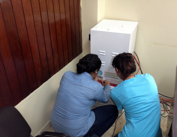
UPI students Estefania Kury and Patricia Eveline help finalize installation of the GPS equipment for COCONet site CN21 in Honduras. Photo by Michael Fend 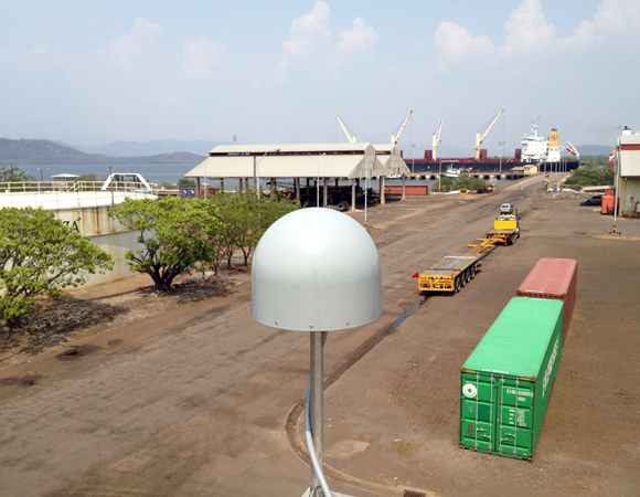
Installation of COCONet continuous GPS site CN21 in San Lorenzo, Honduras. CN21 replaces continuous GPS site SLOR. (Photo/Michael Fend, UNAVCO) 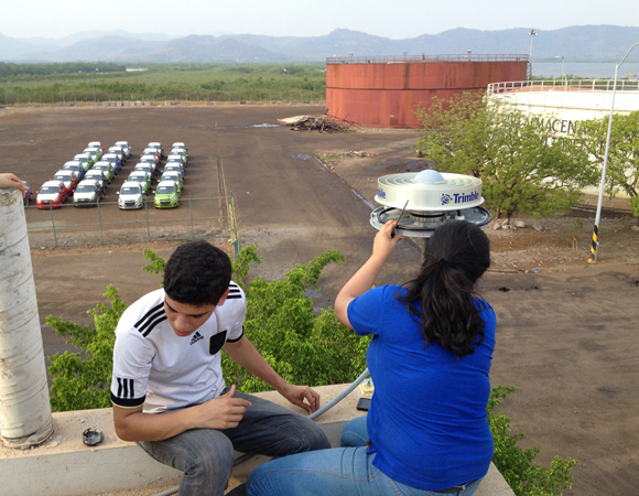
Installation of COCONet continuous GPS site CN21 in San Lorenzo, Honduras. (Photo/Michael Fend, UNAVCO) 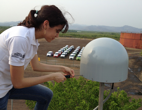
Patricia Eveline, a UPI computer science student, helps finalize the installation of CN21. Photo by Michael Fend.
Project Overview
Determining how the Caribbean plate moves with respect to the neighboring North America and South America plates has been a major challenge. Geologic plate motion models using seafloor magnetic anomaly rates, transform fault azimuths, and slip vectors are challenging due to sparse data. The only rates come from the Cayman Spreading Center, and seismicity at the eastern boundary is low due to slow convergence. Moreover, the boundary geometry is still unclear, since the Caribbean plate’s north and south boundaries are complex deformation zones.
GPS data continue to provide key clues to the Caribbean region’s geologic faults. GPS stations are currently being installed as part of the Continuously Operating Caribbean GPS Observational Network (COCONet), strengthening the indispensible collection of data belonging to a region that faces many atmospheric and geologic natural hazards.
UNAVCO Connection
UNAVCO engineer Michael Fend, in collaboration with Fausto Ramirez and Oscar Meza of the Honduras Instituto de la Propiedad and Luis Eveline of the Universidad Politécnica de Ingeniería de Honduras (UPI), installed CN21 in San Lorenzo, Honduras. Four engineering students from the UPI also participated in the installation, to learn about cGPS. The team installed site CN21 on the roof of the San Lorenzo Port Authority building.
After the installation of CN21, Michael Fend and Luis Eveline finalized logistics for another COCONet cGPS site to be installed on Swan Island, Honduras, in June.
Significance
The COCONet project was funded by the National Science Foundation (NSF) with the aim of developing a large-scale geodetic and atmospheric infrastructure in the Caribbean that will form the backbone for a broad range of geoscience and atmospheric investigations and enable research on process-oriented science questions with direct relevance to geohazards. The Caribbean Plate is a unique opportunity to monitor movement, because most of the plate rests underwater. Prior to this endeavor there has been limited monitoring of the Caribbean Plate. Furthermore, each site is equipped with a weather station which records vital atmospheric data that is analyzed by our friends at the University Corporation for Atmospheric Research (UCAR) to monitor the movement of potentially deadly hurricanes.
Project Information
- Principal Investigators: COCONet
- UNAVCO Engineer(s): Mike Fend
- Dates: May 1 – 2, 2014
- Location(s): COCONet Site CN21: Honduras
- Funding Source: NSF, COCONet
- Map of San Lorenzo, Honduras
Related Links
Written by:
- Mike Fend
- Posted: 25 June 2014
- Last updated: 29 June 2021
- Tags: COCONet, GPS/GNSS, project highlights
-

