
Getting ready to install COCONet GPS site CN47 on Saint Lucia. (Photo/Mike Fend) 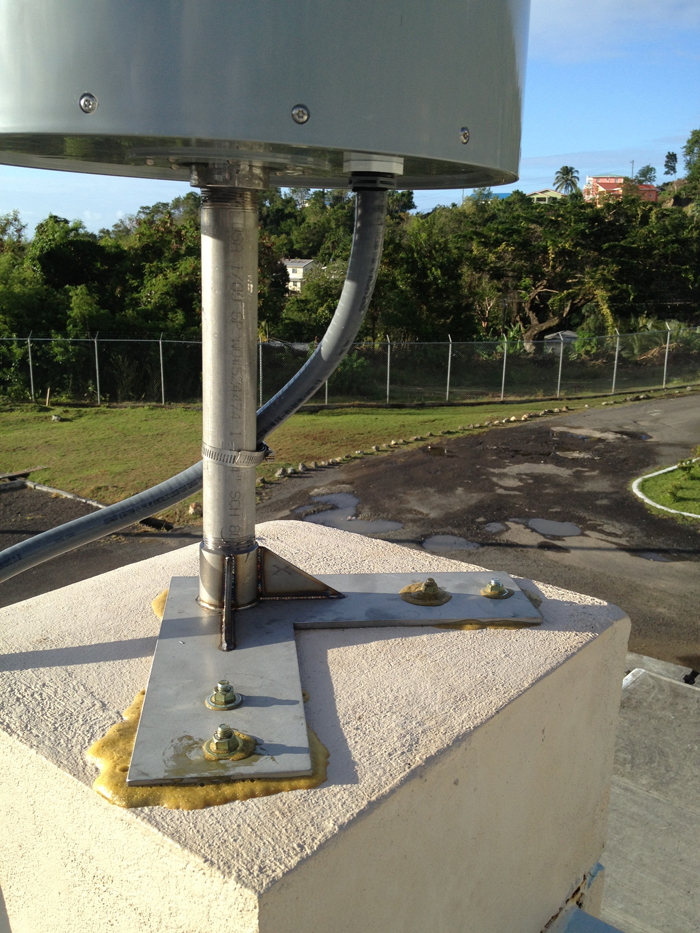
The GPS monument at COCONet site CN47 is a building mount on the roof of St. Lucia’s National Emergency Management Office (NEMO). (Photo/Mike Fend) 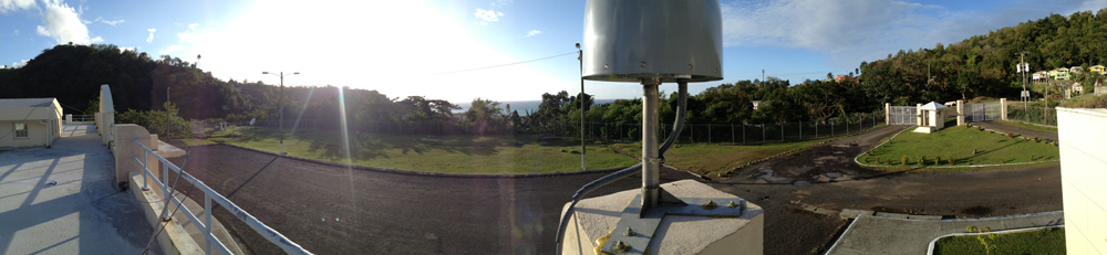
The GPS monument at COCONet site CN47 is a building mount on the roof of St. Lucia’s National Emergency Management Office (NEMO). (Photo/Mike Fend) 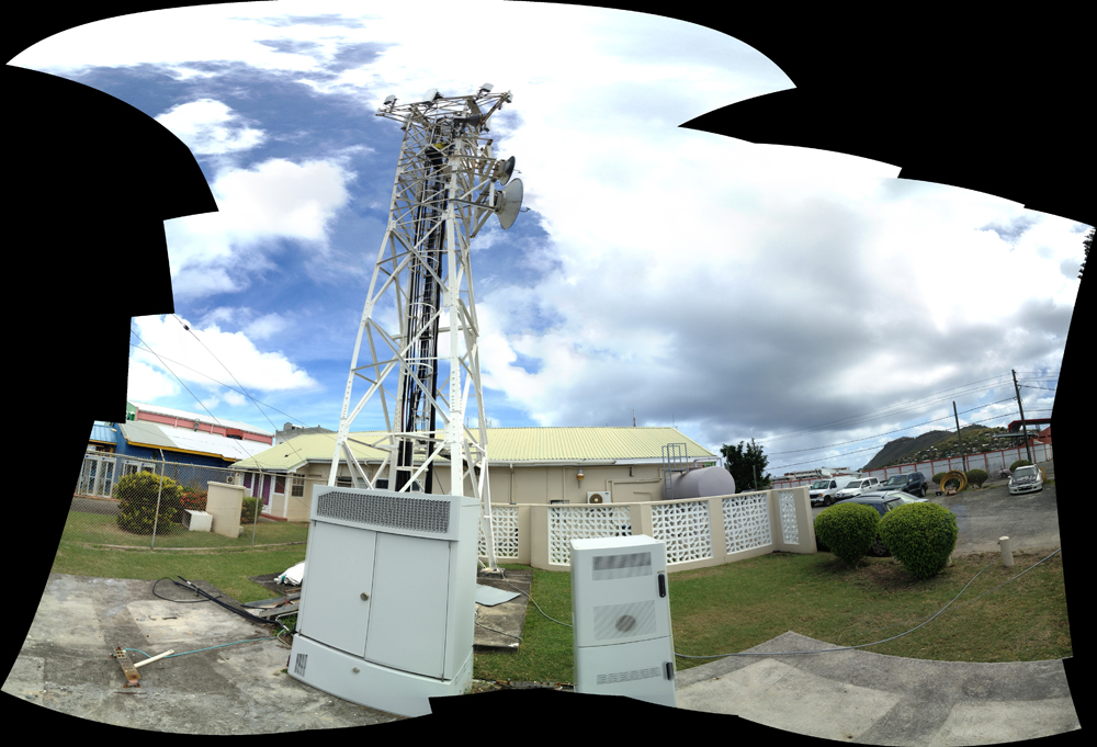
Data from COCONet GPS site CN47 telemeters to a tower at the Cable and Wireless building down in Vieux Fort, Saint Lucia. (Photo/Jacob Sklar) 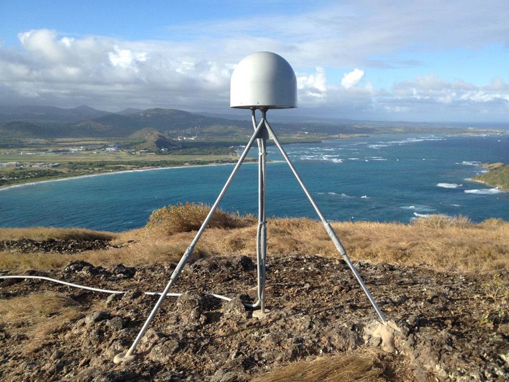
Finished COCONet GPS site CN47 on Saint Lucia, Caribbean, on Friday, Feb. 28, 2014. (Photo/Mike Fend) 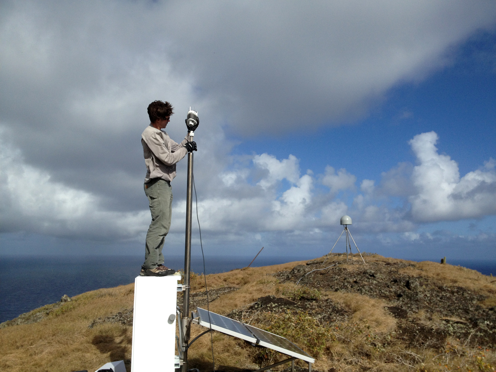
Field engineer Jacob Sklar installs the met pack at COCONet GPS site CN47 on Saint Lucia. (Photo/Mike Fend) 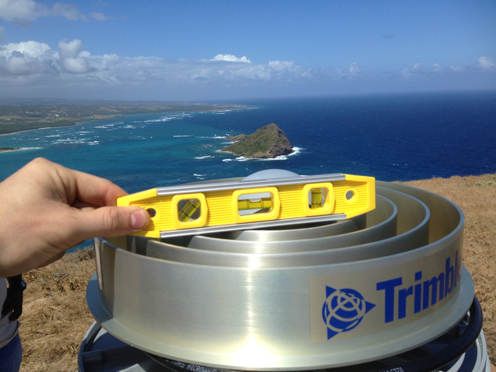
Checking to see that the antenna is level at the installation of COCONet site CN47. (Photo/Mike Fend) 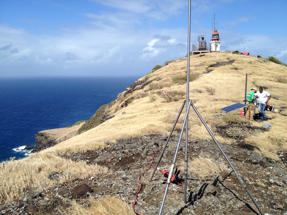
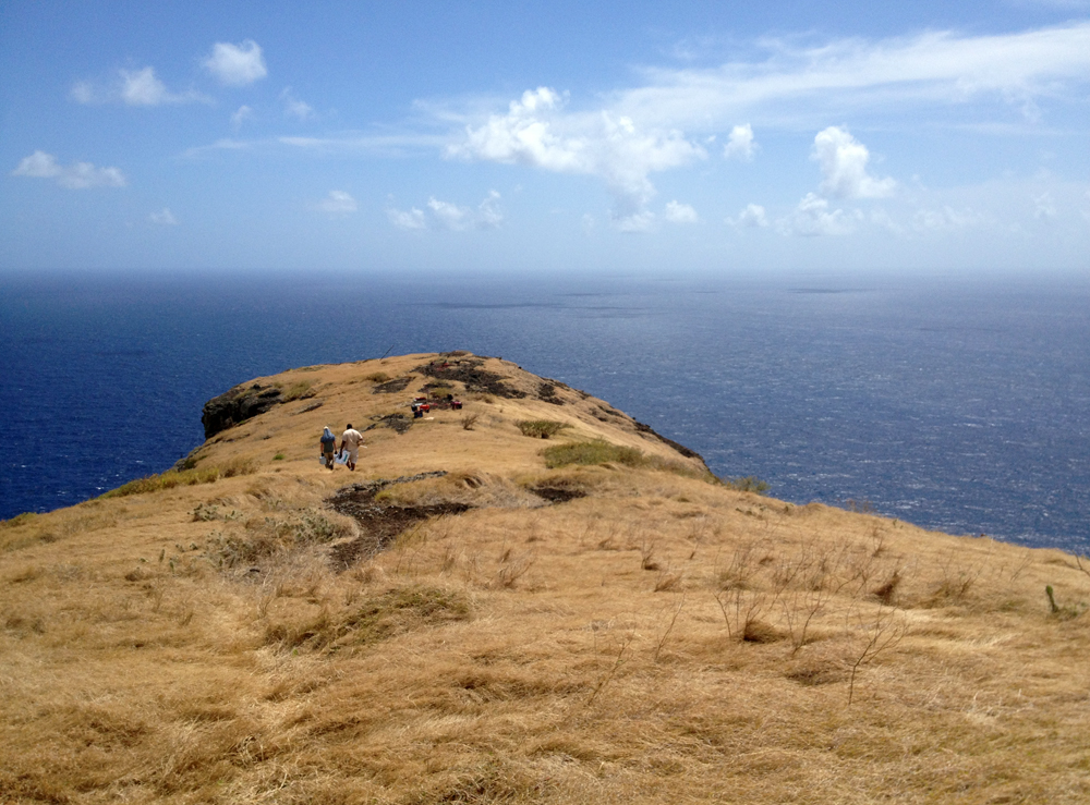
Installation of the short drilled braced monument for COCONet GPS site CN47 on Saint Lucia. (Photo/Jacob Sklar) 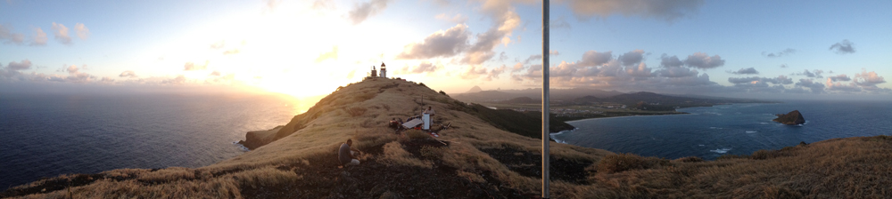
Philip Hippolyte and Machel Higgins work on COCONet site CN47 at sunset on Saint Lucia. (Photo/Mike Fend) 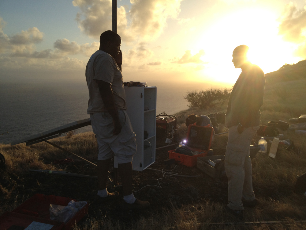
Machel Higgins and Philip Hippolyte stand by the equipment enclosure for COCONet GPS site CN47 on Saint Lucia. In the background, UNAVCO field engineer Jacob Sklar welds for the install. (Photo/Mike Fend) 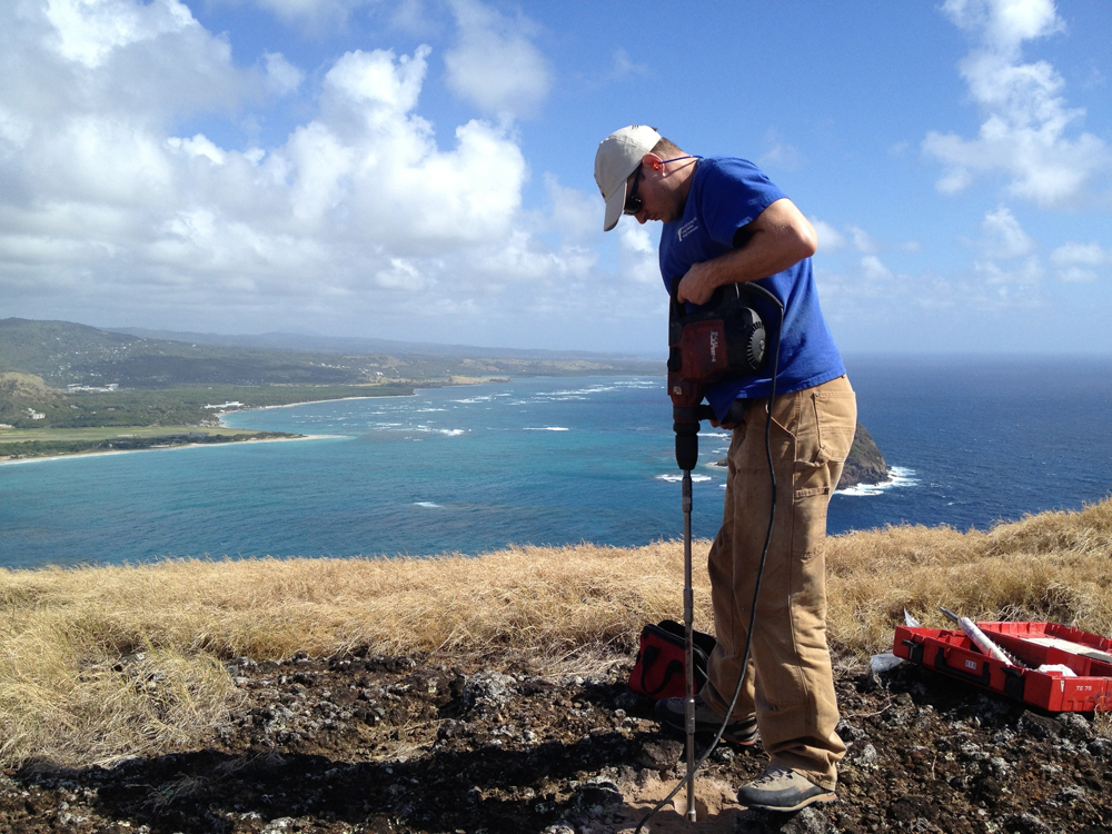
UNAVCO COCONet field engineer Mike Fend drills the center hole for the short drilled braced monument for site CN47 on Saint Lucia in February, 2014.
Overview
Determining how the Caribbean plate moves with respect to the neighboring North America and South America plates has been a major challenge. Geologic plate motion models using seafloor magnetic anomaly rates, transform fault azimuths, and slip vectors are challenging due to sparse data. The only rates come from the Cayman Spreading Center, and seismicity at the eastern boundary is low due to slow convergence. Moreover, the boundary geometry is still unclear, since the Caribbean plate’s north and south boundaries are complex deformation zones.
GPS data continue to provide key clues to the Caribbean region’s geologic faults. GPS stations are currently being installed as part of the Continuously Operating Caribbean GPS Observational Network (COCONet), strengthening the indispensable collection of data belonging to a region that faces many atmospheric and geologic natural hazards.
UNAVCO Connection
UNAVCO engineers, in collaboration with the University of the West Indies and Saint Lucia’s Ministry of Physical Development, Housing and Urban Renewal, installed cGPS sites CN47 and CN04 in Saint Lucia during a 2.5-week trip spanning February and March 2014.
Saint Lucia is located near the center of the Lesser Antilles. Since there are no COCONet sites located immediately north on Martinique and south on Saint Vincent, these two sites will provide important data for this eastern region of the Caribbean plate.
Site CN47 is located near the Vieux Fort Lighthouse, which is the southernmost point of Saint Lucia. Surrounded on three sides by a 200-foot cliff, CN47 experiences 30 mph winds on a daily basis. This location was chosen in part for its exposed basaltic bedrock, 24-hour security, and clear sky view. The telemetry consists of a radio shot to the Cable and Wireless building down in Vieux Fort.
Saint Lucia’s Ministry of Physical Development, Housing and Urban Renewal was instrumental in getting equipment through customs, and has expressed interest in using the CN47 GPS data for surveying purposes. UNAVCO engineers will be upgrading this site to allow for real-time data access early next quarter. Like other COCONet installations, CN47 will provide raw GPS data, GPS precipitable water vapor (GPS-PWV), surface meteorology measurements, and time series of daily positions, as well as a station velocity field to support a broad range of geoscience research.
On the same installation trip, CN04 was installed on the roof of Saint Lucia’s National Emergency Management Office (NEMO). CN04 is another prime location for a COCONet installation, with ample security and a broad sky view. The site is connected directly to a router inside the NEMO building. As Saint Lucia can experience severe hurricanes, NEMO will benefit from the data collected from the weather station.
Collaborations
Sites CN04 and CN07 were installed through collaboration between UNAVCO, University of the West Indies, Saint Lucia’s Ministry of Physical Development, Housing, Urban Renewal and Local Government, and Saint Lucia’s National Emergency Management Office (NEMO). UNAVCO engineers Mike Fend and Jacob Sklar worked closely with Machel Higgins of the University of the West Indies Seismic Research Centre; land surveyor Philip Hippolyte, Deputy Chief Surveyor Vincent Jn. Baptiste, and Deputy Permanent Secretary Hildreth Lewis of Saint Lucia’s Ministry of Physical Development, Housing, Urban Renewal and Local Government; and Mr. Malcolm Job at the NEMO office.
Significance
The COCONet project was funded by the National Science Foundation (NSF) with the aim of developing a large-scale geodetic and atmospheric infrastructure in the Caribbean that will form the backbone for a broad range of geoscience and atmospheric investigations and enable research on process-oriented science questions with direct relevance to geohazards. The Caribbean Plate is a unique opportunity to monitor movement, because most of the plate rests underwater. Prior to this endeavor there has been limited monitoring of the Caribbean Plate. Furthermore, each site is equipped with a weather station which records vital atmospheric data that is analyzed by our friends at the University Corporation for Atmospheric Research (UCAR) to monitor the movement of potentially deadly hurricanes.
Project Information
- Principal Investigators: COCONet
- UNAVCO Engineers: Mike Fend, Jacob Sklar
- Date: February 24 – March 13, 2014
- Locations: COCONet Sites CN04, CN07, & CN047: St. Lucia (map)
- Funding Source: NSF, COCONet
Related Links
Written by:
- Mike Fend
- Posted: 14 March 2014
- Last updated: 30 June 2021
- Tags: GPS/GNSS, project highlights
-

