
Stephen George (UWI-Trinidad) at new COCONet cGPS station CN01 in Antigua, on a nice day. (Photo/Michael Fend, UNAVCO) 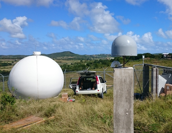
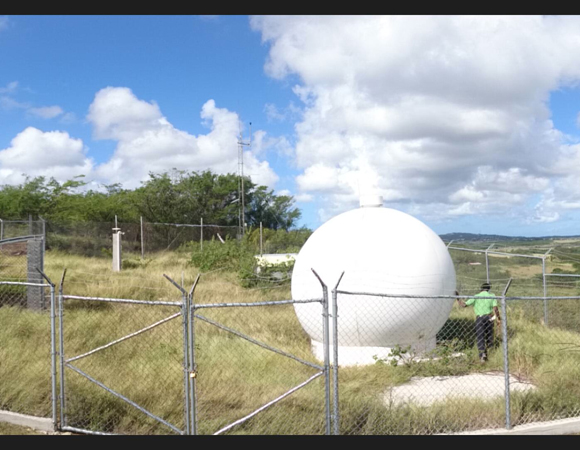
New COCONet cGPS station CN01 in Antigua. Like the GPS antenna (center), the VSAT here is protected by a radome (white dome on left). (Photo/Michael Fend, UNAVCO) 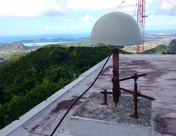
BGGY pre-makover. Years of the elements had caused the monument to rust. (Photo/Michael Fend, UNAVCO). 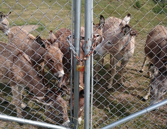
New COCONet cGPS site CN01 in Antigua is on a donkey reserve. Hello, donkeys! (Photo/Michael Fend, UNAVCO) 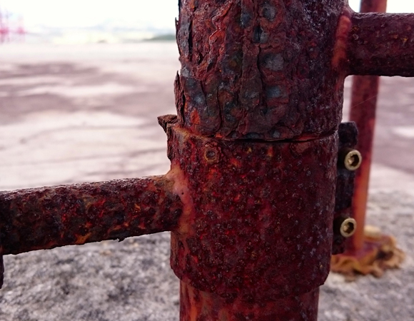
A close-up of years of accumulated rust at station BGGY. (Photo/Michael Fend, UNAVCO) 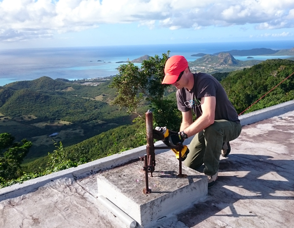
UNAVCO engineer Michael Fend grinds rust off the mounument at BGGY. (Photo provided by Michael Fend, UNAVCO) 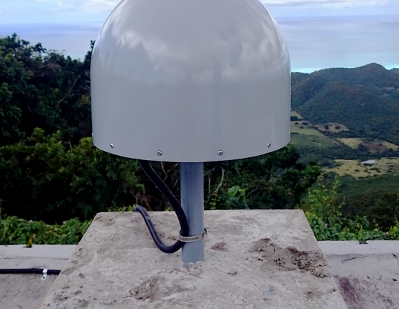
Station BGGY, post-makeover. (Photo/Michael Fend, UNAVCO) 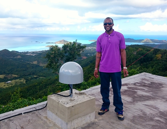
Myren Ward of the Antigua and Barbuda National Office of Disaster Service with improved station BGGY. (Photo/Michael Fend, UNAVCO) 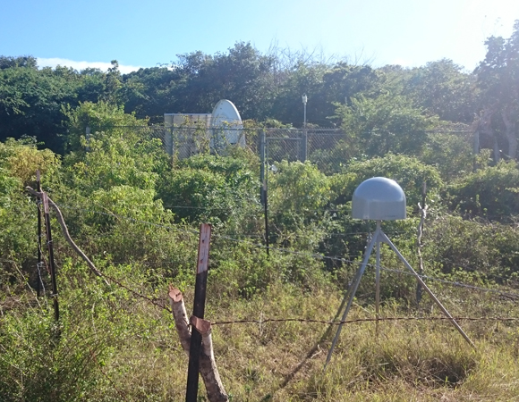
Improvements at station CN00 in Barbuda include a new GPS antenna and receiver. (Photo/Michael Fend, UNAVCO) 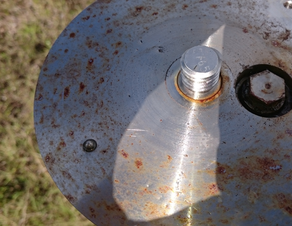
A rusty GPS antenna mount at station CN00 in Barbuda. (Photo/Michael Fend, UNAVCO)
Project Overview
Determining how the Caribbean plate moves with respect to the neighboring North America and South America plates has been a major challenge. Geologic plate motion models using seafloor magnetic anomaly rates, transform fault azimuths, and slip vectors are challenging due to sparse data. The only rates come from the Cayman Spreading Center, and seismicity at the eastern boundary is low due to slow convergence. Moreover, the boundary geometry is still unclear, since the Caribbean plate’s north and south boundaries are complex deformation zones.
GPS data continues to provide key clues to the Caribbean region’s geologic faults. GPS stations are currently being installed as part of the Continuously Operating Caribbean GPS Observational Network (COCONet), strengthening the indispensable collection of data belonging to a region that faces many atmospheric and geologic natural hazards.
UNAVCO Connection
During this maintenance and installation trip, UNAVCO engineer Michael Fend collaborated with Philmore Mullin of the Antigua and Barbuda National Office of Disaster Service (NODS), Stephen George of University of the West Indies (UWI) Trinidad, and Jared Anderson at the US Geological Survey (USGS).
Fend and George installed COCONet cGPS station CN01 at UWI Trinidad’s seismic site ANBD, located on Antigua’s Donkey Sanctuary & Animal Shelter at Bethesda. This site collaboration allows CN01 to telemeter cGPS data through the UWI VSAT Internet connection.
After the site installation, Fend and George traveled to Boggy Peak/Mt. Obama in Antigua. Years of weather had taken their toll on the BGGY monument, but the two were able to provide a second life for this station by grinding off rust and adding marine paint. With the addition of a new antenna, dome and receiver BGGY is ready for another eight years of weather. Additionally, Fend was able to make some minor network changes to get UWI seismic site BPA back online.
Traveling 40 miles north, Fend arrived in Barbuda to service station CN00. This cGPS is co-located with the USGS seismic site ANWB, and again telemeters data through their satellite connection. Fend worked with Anderson to bring both CN00 and ANWB back online via the Hughesnet satellite system. CN00 also received a new antenna and receiver.
The final tally is one new cGPS station, two upgraded and refurbished cGPS sites, and two seismic sites back online. No donkeys were harmed during this trip.
Significance
The COCONet project was funded by the National Science Foundation (NSF) with the aim of developing a large-scale geodetic and atmospheric infrastructure in the Caribbean that will form the backbone for a broad range of geoscience and atmospheric investigations and enable research on process-oriented science questions with direct relevance to geohazards. The Caribbean Plate is a unique opportunity to monitor movement, because most of the plate rests underwater. Prior to this endeavor there has been limited monitoring of the Caribbean Plate. Furthermore, each site is equipped with a weather station which records vital atmospheric data that is analyzed by our friends at the University Corporation for Atmospheric Research (UCAR) to monitor the movement of potentially deadly hurricanes.
Project Information
- Principal Investigators: COCONet
- UNAVCO Engineer(s): Michael Fend
- Date: January 24 – February 6, 2015
- Locations: Antigua and Barbuda
- Funding Source: NSF, COCONet
- Map of Antigua
Related Links
Written by:
- 23 February 2015
- Posted: 23 February 2015
- Last updated: 25 June 2021
- Tags: COCONet, GPS/GNSS, project highlights
-

