
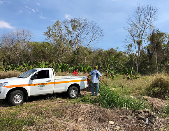
CN56 replaces the monumentation for CN34, which proved unstable. ANATI and IGNTG transported the team from Panama City to the site and back after helping with the installation. (Photo/Dylan Schmeelk, UNAVCO) 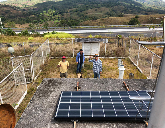
Gorki, Javier, and Omar (left to right) after compleing repairs including a new battery, GPS receiver, and solar charge controller at cGPS station CANZ, April 2018. (Photo/Dylan Schmeelk, UNAVCO) 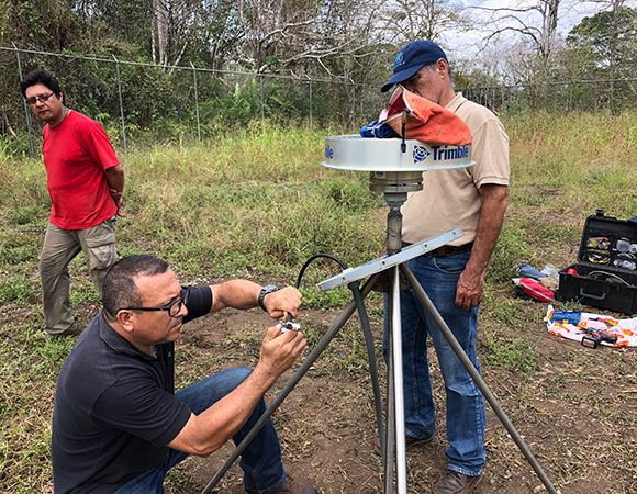
Gorki and Demetrio watch as Javier puts the finishing touches on the GPS antenna cable at what is now CN56. (Photo/Dylan Schmeelk, UNAVCO) 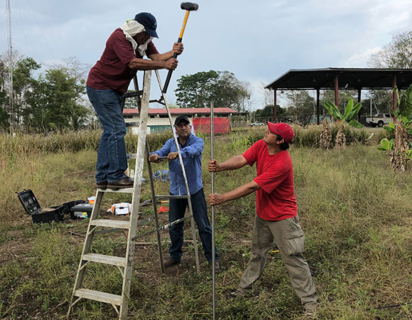
Demetrio Garcia, Javier, and Gorki begin the installation of the shallow driven braced monument for CN56. (Photo/Dylan Schmeelk, UNAVCO) 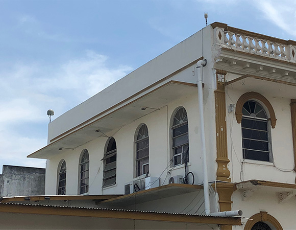
Station CN55, mounted on the Municipo de Aguadulce Building in Aguadulce. (Photo/Dylan Schmeelk, UNAVCO) 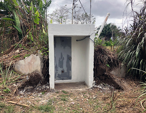
The bunker that housed CN34 GPS equipment still houses the same equipment minus the antenna, which was on the roof. (Photo/Dylan Schmeelk, UNAVCO)
Project Overview
Over two weeks in April 2018, PhD student Gorki Ruiz from The Pennsylvania State University (PSU), Omar Espinoza (Sub-Director General), Javier Cornejo (Departamento de Geodesia) and Demetrio Garcia (Departmento de Cartografia) from Instituto Geográfico Nacional “Tommy Guardia” (IGNTG) / Autoridad Nacional de Administración de Tierras (ANATI), and Dylan Schmeelk from UNAVCO traveled throughout much of Panama to service previously installed continuous GPS stations (cGPS), including relocation of one station, and the relocation of a GPS antenna at another. This was part of an ongoing project (PI Peter La Femina (PSU)) to investigate the complex interactions between the Caribbean, Cocos, and Nazca plates. Collaboration with the Instituto de Geociencias at the Universidad de Panama (IGC) was essential to the success of the equipment relocations. During this trip, the team visited six cGPS sites. This took 14 days and over 1,600 km of driving!
International Collaboration
This recent field excursion to Panama builds on previous work from 2011 when Brendan Hodge (UNAVCO), Peter La Femina (PSU), and IGC staff installed five continuous GPS sites as part of a National Science Foundation Early CAREER award to La Femina. In recent years, collaboration between UNAVCO/PSU and ANATI, the surveying and mapping agency of Panama, has increased significantly, benefitting all parties, with future work on the horizon. Multiple stations managed by ANATI recently suffered fire damage, for which UNAVCO was able to supply antenna cables to help facilitate bringing the stations back online. ANATI is also excited about the possibility of training some of their staff to QC and process GPS data, currently being sent to other countries for processing, using teqc and GAMIT/GLOBK. Collaborations like these are vital for the continuation of geodetic research in the region.
COCONet Maintenance
In addition to visiting PSU GPS sites, COCONet sites CN33 and CN34 were decommissioned and two new replacement sites, CN55 and CN56, were installed. Installation of underground piping caused the structure hosting the geodetic antenna monument for station CN33, in Penonome, to tilt. The subtle tilt of the structure was captured by the GPS observations and ultimately corrupted these data. A new location was identified in the nearby city of Aguadulce during the 2017 maintenance trip. Station CN55 was installed on the roof of the municipal building on this trip (Figure 6).
With support from IGNTG/ANATI, the antenna monument once used for CN34 was relocated 25 m away using shallow driven braced monumentation for the new station CN56. Due to a power supply issue at this site, the GPS had also failed. Fortunately, the collaboration with PSU will allow a GPS swap without the cost of an additional trip. This is a great example of how vital local Panama collaborations are to saving time and money on basic maintenance to keep data flowing.
Project Information
- Principal Investigator: Peter LaFemina
- UNAVCO Engineer: Dylan Schmeelk
- Dates: April 2 – 15, 2018
- Location(s): Panama
- Funding Source: NSF
- Map of Panama
Related Links
Written by:
- Dylan Schmeelk
- Posted: 22 May 2018
- Last updated: 4 June 2021
- Tags: GPS/GNSS, project highlights
-

